Tracking the Origins of Atmeh Camp: Bellingcat Challenge #107 Walkthrough
Bu çözümün Türkçesi de var: sağ üstten dili TR yapın.
Solving Bellingcat’s GEOINT challenge #107, Internal Displacement, proved to be an exercise in spatial awareness, regional land-use analysis, and rigorous historical satellite verification.
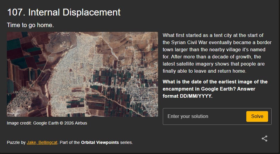
The prompt presented a sprawling border settlement that evolved from an informal tent city into an urbanized displacement zone far larger than the settlement it was named after.
Regional Elimination and Geolocation
Following the outbreak of the Syrian Civil War, numerous spontaneous and formal camps emerged along both sides of the Turkish-Syrian border. Initial scoping began along Turkey’s border provinces, including Hatay, Gaziantep, and Kilis.
Comparing the satellite footprint against the prompt revealed crucial morphological clues:
- The parcel boundaries, agricultural textures, and road networks on the Turkish side followed distinct Cadastral and land-allocation patterns that did not match the immediate surroundings of the target settlement.
- Shifting the investigation south of the border across northern Syria—scanning Kobani, Azaz, and Idlib—led directly to Atmeh (Atma), Syria, situated right on the border adjacent to Hatay province. The spatial layout of the olive groves, road geometry, and the original village footprint to the east confirmed a definitive match.
Temporal Analysis via Google Earth Historical Imagery
The objective was to identify the exact date of the earliest satellite capture in Google Earth showing the encampment.
Working backward through Google Earth’s historical imagery from the latest capture on 02/08/2025, the physical footprint of the camp receded steadily toward its point of origin:
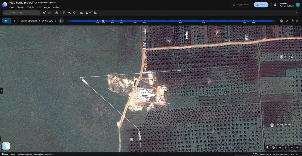
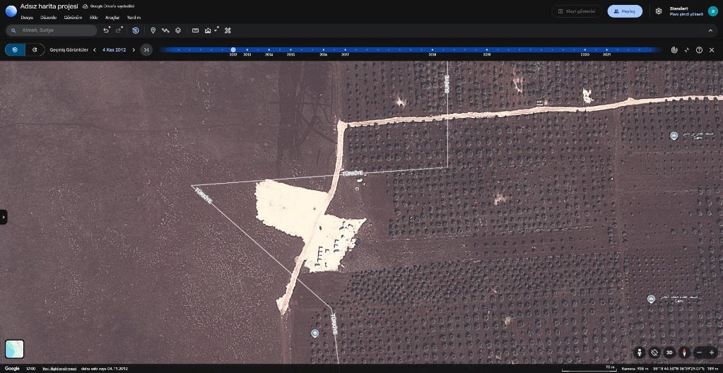
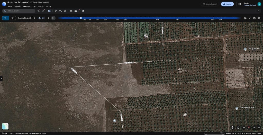
This confirmed that 04/11/2012 is the earliest satellite capture documenting the encampment’s initial footprint in Google Earth.
A huge thank you to Jake Godin and Bellingcat for designing another brilliant, methodically grounded GEOINT puzzle in the Orbital Viewpoints series.
Originally published on Substack