Hunting Ghosts at Sea: How Visual Feature Correlation and AIS Telemetry Solved a Maritime Tracking Case
Bu çözümün Türkçesi de var: sağ üstten dili TR yapın.
Most writeups make OSINT look like a straight line from question to answer. In reality, it is a demanding process full of dead ends, deceptive sister hulls, and microscopic visual details. This investigation began with a single blurry image of an industrial fishing vessel hauling its net out at sea. The objective was to positively identify the vessel, extract its official IMO number, and verify the specific port where it was docked on February 8, 2026.
Here is the unpolished operational breakdown of how that vessel was tracked down.
Step 1: The Initial Hook and Architectural Clues
The investigation began with an in action photograph showing an active purse seiner working its gear.
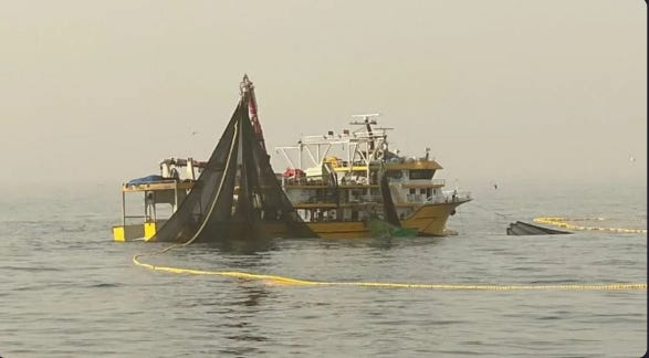
Reading any official registry or call sign off the superstructure was initially impossible due to heavy pixelation and haze. However, naval architecture provided the first solid lead. The hull layout, high aft gantry structure, distinctive bridge wings, and auxiliary skiff deck pointed directly to Turkish Black Sea shipbuilding traditions. These heavy duty purse seiners are typically constructed in Turkish yards and deployed for commercial operations along the West African coast.
With raw text extraction off the table, the visual feature correlation focused on three critical geometric markers:
- The sharp, angled black striping running along the lower bow section.
- The slight backward rake and curved profile of the forward radar mast above the bridge.
- The specific rigging and hydraulic arm configuration mounted on the working deck.
Step 2: Falling into the Sister Ship Traps
Turkish commercial shipyards frequently construct sister vessels using standardized architectural blueprints. This reality quickly turned the initial search into a minefield of near identical lookalikes.
A broad visual query targeting yellow hulled Turkish industrial fishing vessels surfaced dozens of candidate hulls built by yards such as Akasia Yachting and Başaran.
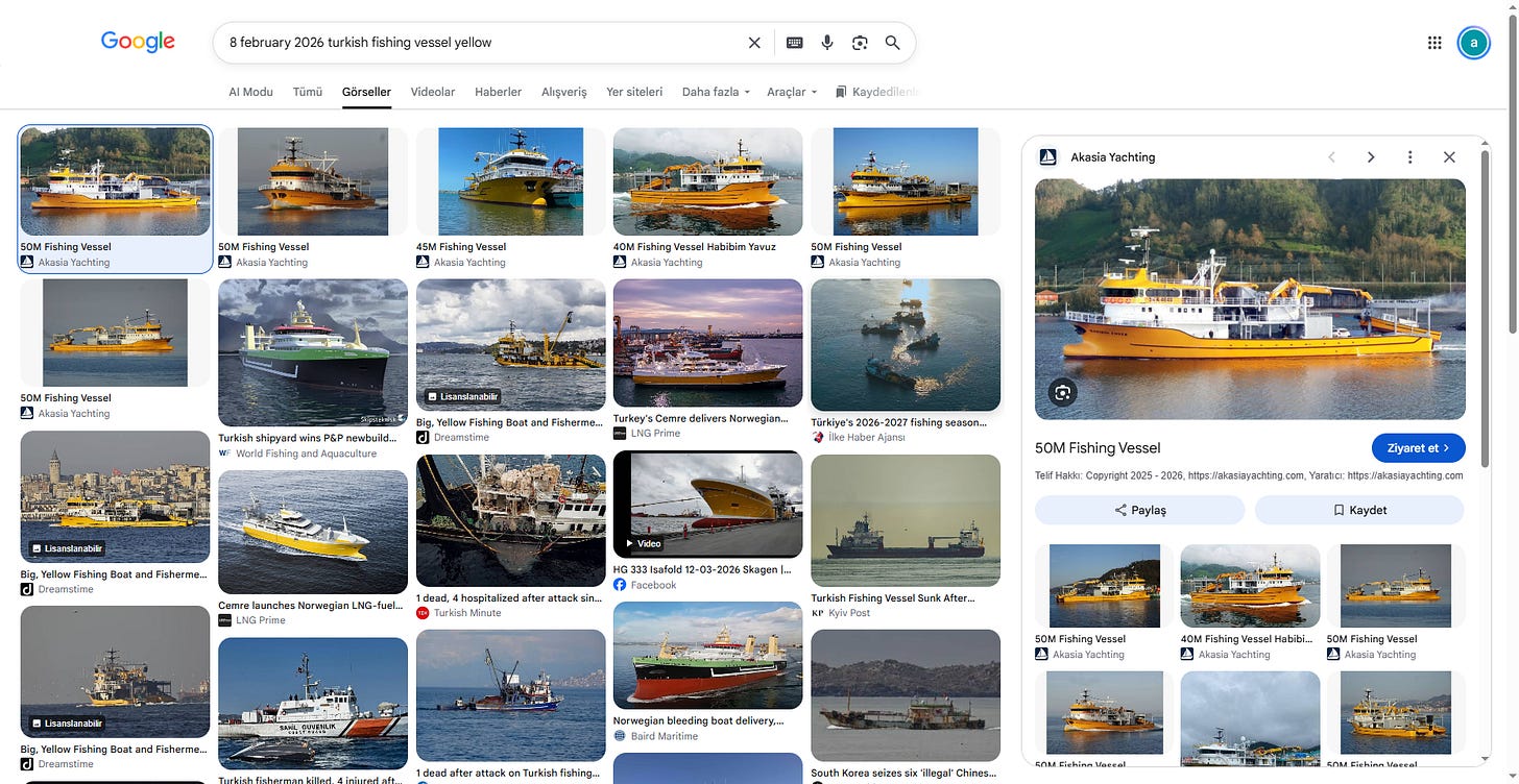
This is where the first round of false positives occurred. Several candidates matched the primary hull color, general length, and auxiliary deck setups.
One prominent match was a 50 meter vessel featured in commercial sales listings, alongside known fleet variants like Habibim Yavuz
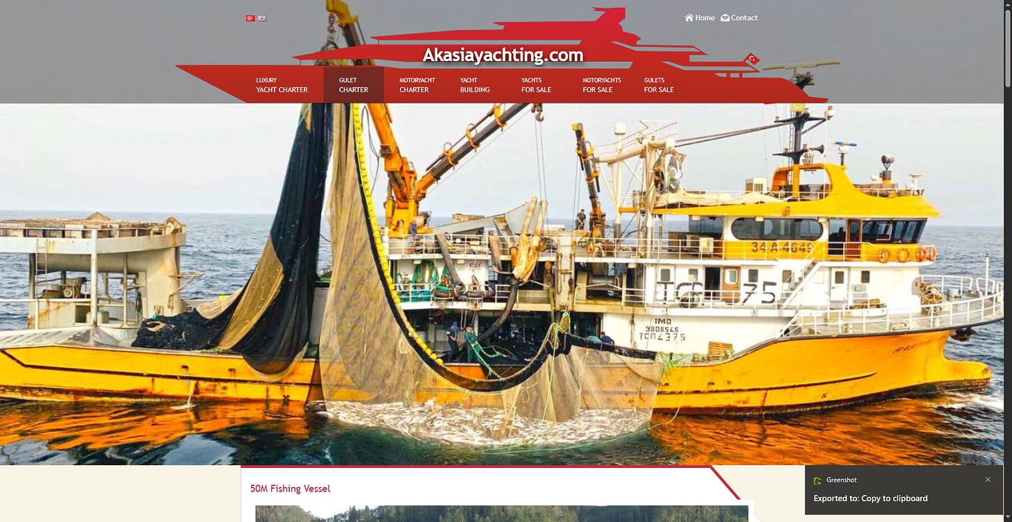
Cross referencing Figure 3 against the target revealed distinct structural discrepancies:
- The candidate hull featured straight, parallel accent lines rather than the sharp forward bend seen on the target.
- The forward radar mast on the candidate was completely vertical, lacking the specific curved rake present on the target vessel.
- Bridge wing markings and window arrangements failed to align with the original image.
Three to four candidate vessels were systematically eliminated through this structural comparison process.
Step 3: Finding the True Source Image
Abandoning blind registry queries, the next phase centered on finding the authentic source photograph within specialized maritime databases.
The breakthrough arrived when the exact operational photograph was located on MarineTraffic, documented by photographer Erhan Türkmen.
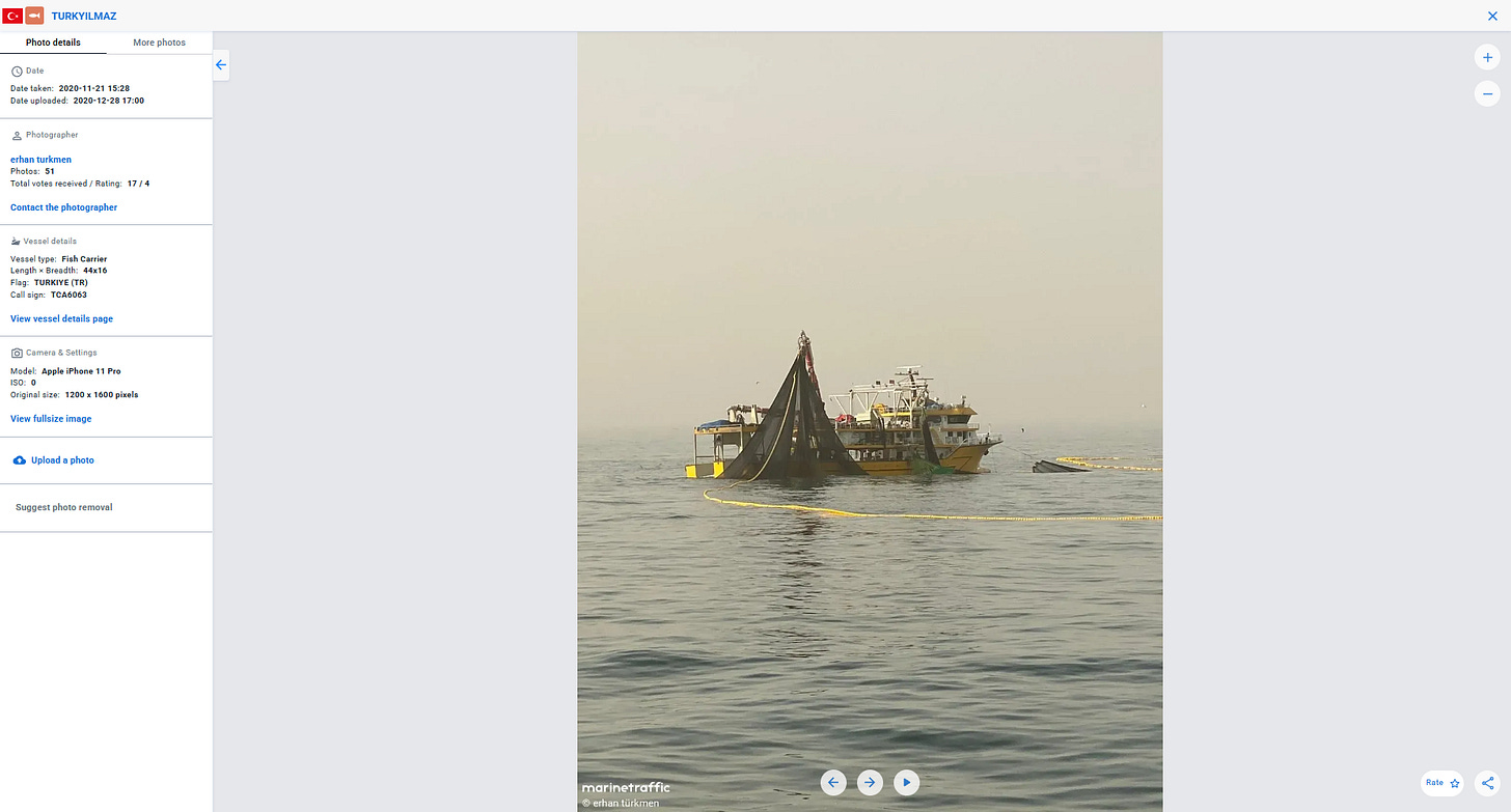
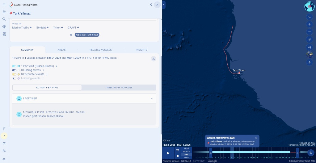
The platform activity log confirmed the vessel remained stationary in port throughout that timeframe:
- Port Entry: January 2, 2026, 9:12 PM UTC
- Port Departure: February 26, 2026, 6:59 PM UTC
- Status: Docked continuously for 54 days at Bissau, Guinea Bissau
February 8, 2026 fell directly within this docking period.
Step 5: The UN/LOCODE Trap
Identifying the port as Bissau seemed to conclude the search, but submitting standard phonetic abbreviations resulted in immediate failures.
Under the United Nations Code for Trade and Transport Locations (UN/LOCODE), Bissau does not follow intuitive letter ordering. Instead, it derives its location code from its primary international transport hub, Osvaldo Vieira (OXB):
- Country Code: GW (Guinea Bissau)
- Location Code: OXB
The official, verified UN/LOCODE entry is GWOXB, rather than GWBXO or GWBIS.
Combining the validated IMO with the official port designation completed the target flag:
9920928-GWOXB
Key Takeaways
- Structural architecture over pixels: When resolution fails, hull geometry and mast curvature serve as non negotiable identifiers.
- Account for shipyard duplication: Commercial sister vessels demand rigorous micro feature verification before accepting a match.
- Validate standardized codes at the source: Geographic names must always be checked against authoritative UN/LOCODE registries rather than assumed patterns.
Social
Originally published on Substack