Geolocation Write-up: OSINT Exercise #030 by Sofia Santos (Gralhix)
Bu çözümün Türkçesi de var: sağ üstten dili TR yapın.
A massive thank you to Sofia Santos (Gralhix) for creating another outstanding, realistic, and methodologically rewarding OSINT exercise. Her challenges consistently push the boundaries of open-source investigations, especially when dealing with dynamic terrain and historical events.
Task Briefing & Objective
The objective of OSINT Exercise #030 is to identify the precise geographic location of the large white emergency tent seen at the 1:16 mark of an October 2007 UNHCR video report covering the refugee crisis in the Democratic Republic of the Congo (DRC).
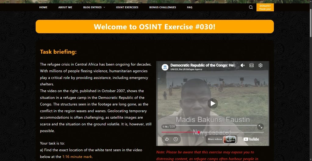
Methodology Overview
To pinpoint temporary infrastructure that disappeared years ago, I structured my investigation into four distinct steps:
- Context & Chronology Mining: Extracting regional keywords and dates from contemporary humanitarian reporting.
- Topographical Triangulation: Locating unique natural landmarks (volcanic terrain, crater lakes) via ground and aerial imagery.
- Micro-Landmark Correlation: Verifying specific structural assets using geotagged photos and historical overhead layers.
- Target Area Demarcation: Enclosing the candidate perimeter in Google Earth Pro using historical satellite data.
Step 1: Initial Context & Open-Source Research
Reviewing the video and the briefing immediately pointed to the North Kivu province in eastern DRC.
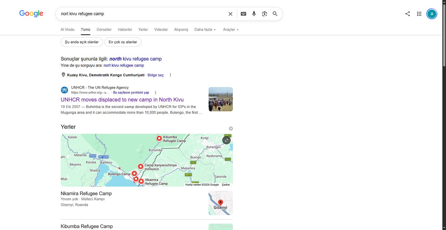
I began with a focused search query: north kivu refugee camp. This led directly to an official UNHCR press release dated October 19, 2007, detailing the movement of Internally Displaced Persons (IDPs) across the Goma and Mugunga sectors.
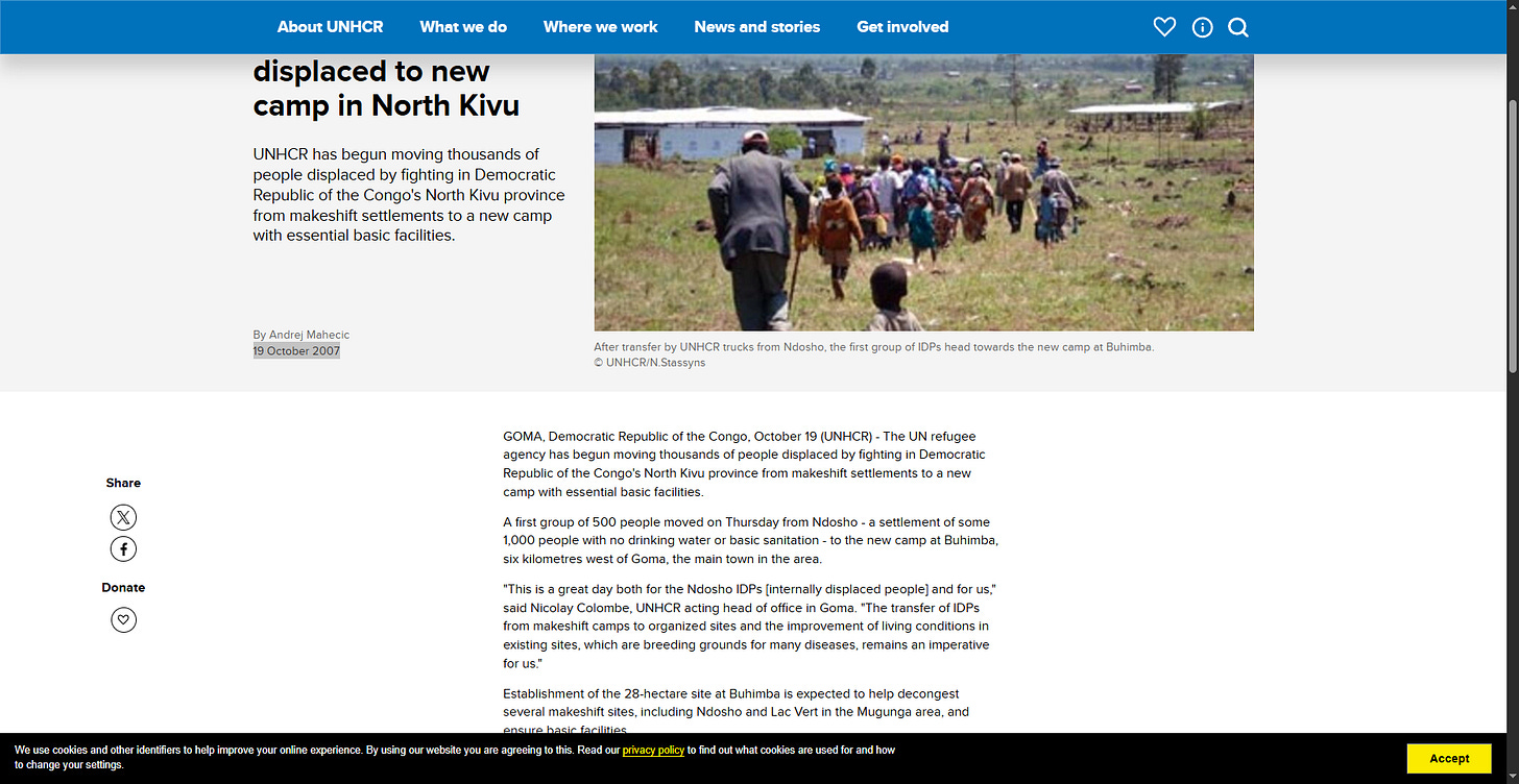
The report, titled "UNHCR moves displaced to new camp in North Kivu," provided critical historical context regarding camp openings and living conditions during that exact month.
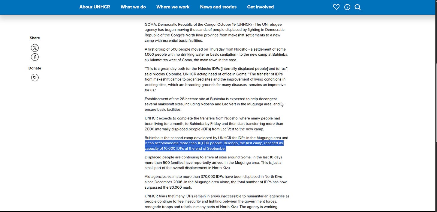
Reading through the release revealed a crucial breakthrough. While the Buhimba camp was still under construction in October 2007, the first major organized camp in the Mugunga area was Bulengo, which had reached its capacity of 10,000 IDPs at the end of September 2007. This timeline matched our video footage perfectly.
Step 2: Visual Correlation & Landscape Discovery
Next, I gathered visual reference material from the ground and air by querying camps de refugees bulengo. This query uncovered a valuable aerial photograph on Flickr titled “Aerial View of Camps for People Displaced by Conflict.”
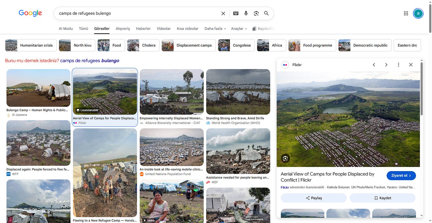
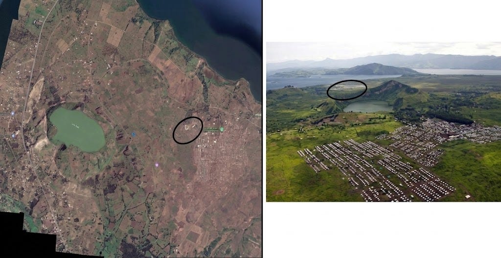
The aerial perspective revealed a distinct crater lake situated behind prominent volcanic ridges, flanked by dense rows of temporary shelters and centralized administrative zones.
By analyzing local terrain maps and satellite imagery around Goma, I matched this crater lake to Lake Vert (Lac Vert), confirming the exact macro-location of the Bulengo camp complex.
Step 3: Ground-Level Landmark Verification
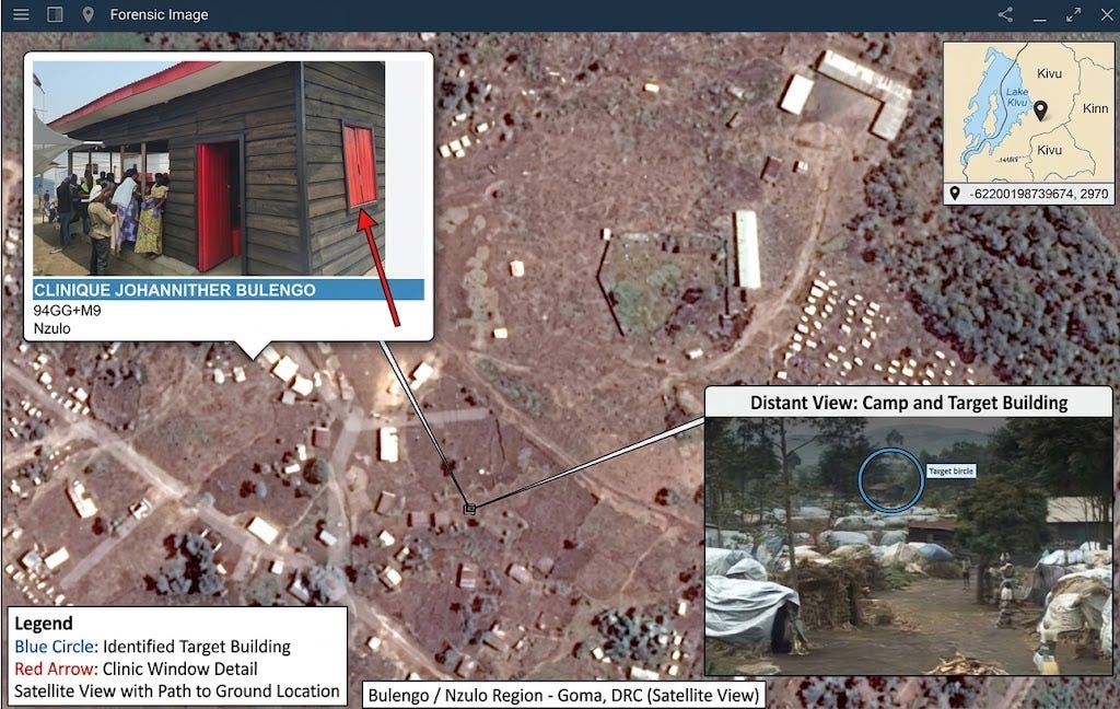
I then zoomed into historical satellite imagery of the Bulengo site to look for persistent physical infrastructure. Near the main access corridor, I identified an administrative and medical point of interest labeled Clinique Johanniter Bulengo.
Cross-referencing the available ground-level photography of this wooden medical structure against the camp video confirmed identical timber construction, roof pitch, and perimeter layout.
Step 4: Pinpointing the Target Zone
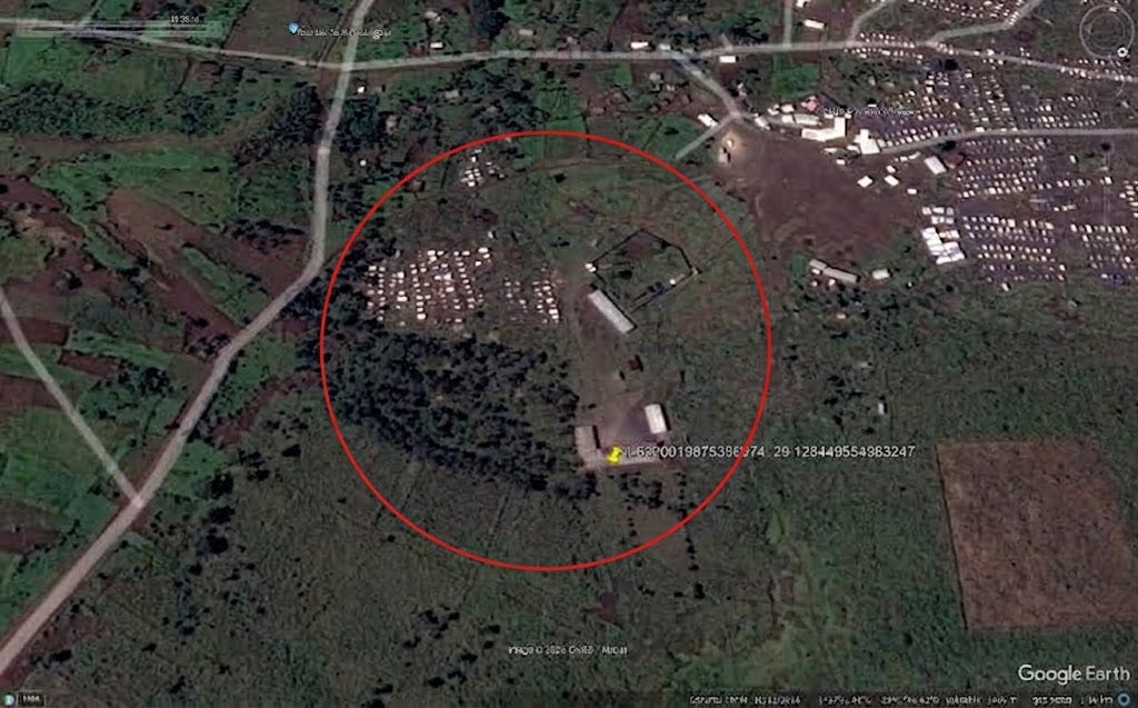
Because temporary IDP settlements evolve rapidly, structures recorded in 2007 shifted significantly across later satellite passes. Rather than guessing an exact square meter for a fabric structure that has long vanished, I isolated the operational cluster where large communal tents were erected adjacent to the administrative compound.
Using historical satellite imagery in Google Earth Pro, I drew a targeted perimeter around the active 2007 tent sector.
Conclusion
By combining contemporary humanitarian reporting, panoramic aerial matching, and ground-level facility verification, I traced the 2007 footage from a broad provincial level down to the exact operational grounds of the Bulengo IDP camp.
- Target Site: Bulengo IDP Camp, West of Goma, North Kivu, DRC
Originally published on Substack