Bellingcat OSINT Challenge: The Frozen North — Step-by-Step Walkthrough
Bu çözümün Türkçesi de var: sağ üstten dili TR yapın.
Pinpointing a vessel in the Arctic via solar chronolocation (SunCalc), filename metadata extraction, and Sentinel satellite imagery.
- Challenge Overview
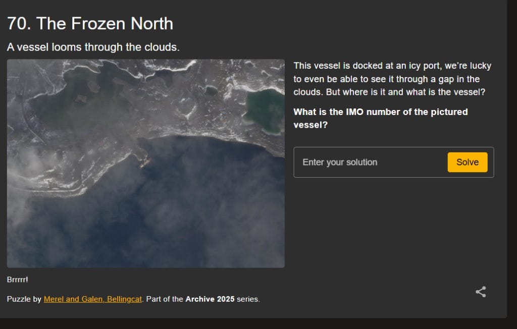
In challenge #70 (“The Frozen North”) from Bellingcat’s Archive series, we are provided with a satellite image partially obscured by clouds. It depicts an isolated vessel docked at a frozen, remote port.
Our objective: Identify the port location and determine the IMO number of the docked vessel.
- Filename Metadata: The Initial Breakthrough
Reverse image tools like Google Lens are ineffective on cropped satellite tiles. The first step was inspecting the image source directly.
Looking at the tab title and the original image filename, the timestamp immediately stood out: 20220901_091318.png

This follows the standard naming structure of satellite imaging platforms:
- Date: September 1, 2022 (20220901)
- Time: 09:13:18 UTC (091318)
- Visual & Shadow Analysis
With the exact capture time secured, I examined the satellite image for environmental and lighting cues.
Key observations:
- The North / North-East areas were visibly brighter and receiving direct sunlight. Given the cold, arctic landscape, plausible regions included Alaska, Siberia, Northern Russia, or Scandinavia.
- The shadows of small structures along the coast were cast toward the North-Northwest / North.
- Shadows pointing north indicated that the sun was positioned in the South-Southeast / South (high in the sky, approaching solar noon).
- Chronolocation with SunCalc
To narrow down the longitude, I turned to SunCalc.
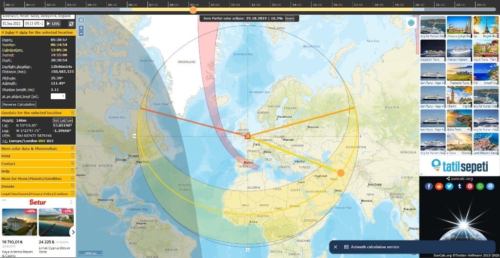
Setting the reference point to Greenwich revealed 09:13 UTC+1 due to British Summer Time. To compensate and match the true 09:13 UTC capture time, I adjusted the clock to 10:13. At Greenwich, the solar azimuth was 111.49°, placing the sun far too eastward compared to our image’s shadows.
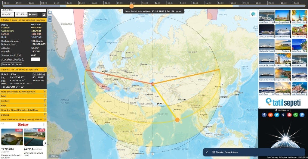
To align the sun with the South-Southeast direction shown by the shadows, I shifted the pin eastward toward Scandinavia and Russia.
Placing the pin around 50.40° E longitude brought the sun to an azimuth of 145.52°, matching the shadow directions in the satellite capture.
- Satellite Verification: Nagurskoye Base
Following the ~48°E — 50°E meridian northward into the Arctic, I cross-referenced coastal settlements and military outposts via Google Maps and Google Earth. The terrain matched Nagurskoye Base (80°48' N, 47°40' E) on Franz Josef Land.
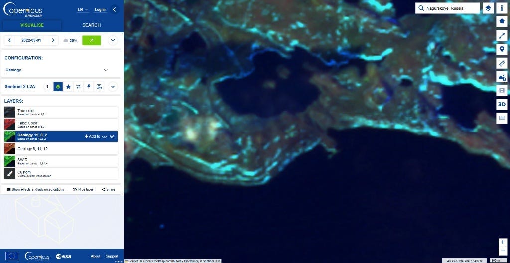
To confirm, I loaded Sentinel-2 L2A imagery on Copernicus Browser for September 1, 2022:
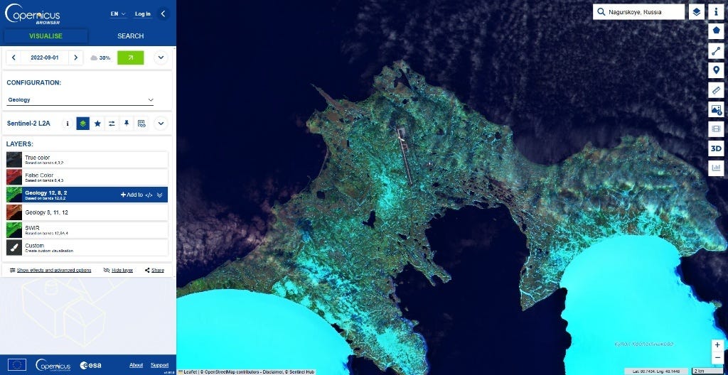
Zooming into the southwestern bay confirmed the location:
- The distinctive contours of the northern lake.
- The curved coastal roadway.
- The small pier extending into the water where the ship was docked.
- AIS Vessel Identification & IMO
With the exact coordinates and date established, I queried AIS historical databases (Global Fishing Watch / MarineTraffic) filtered for 2022–09–01.
Only one cargo vessel was active and docked at Nagurskoye on that date:
- Vessel Name: Mekhanik Pyatlin
- Type: General Cargo (Russian Flag)
- IMO Number: 8904434
Conclusion
Submitting 8904434 solved the challenge. This puzzle is a solid example of combining metadata inspection, solar azimuth calculations via SunCalc to isolate a meridian, and multi-source satellite verification.
Originally published on Medium