Bellingcat CTF #106: Shifting Sands — Walkthrough
Bu çözümün Türkçesi de var: sağ üstten dili TR yapın.
Challenge Breakdown
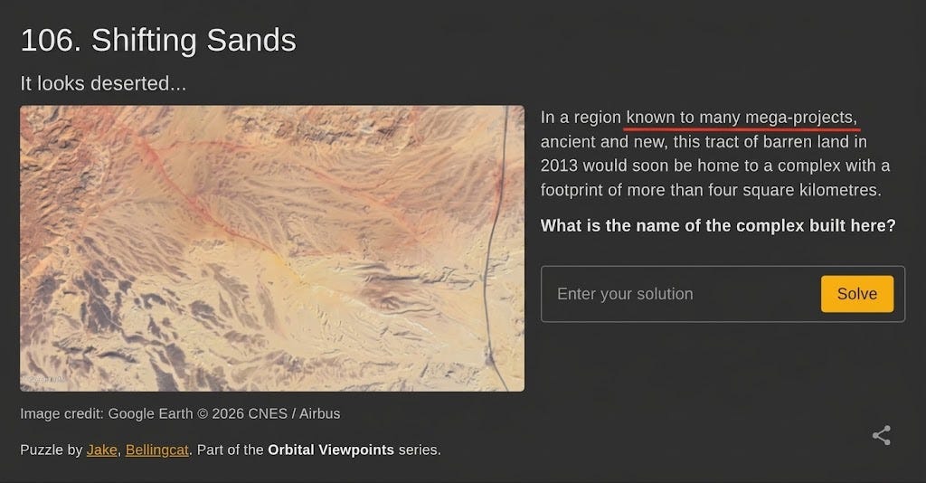
The challenge presents an aerial satellite capture of barren desert terrain marked with faint perimeter markings:
“In a region known to many mega-projects, ancient and new, this tract of barren land in 2013 would soon be home to a complex with a footprint of more than four square kilometres. What is the name of the complex built here?“
Step 1: Textual Analysis & Eliminating Assumptions
The phrase "known to many mega-projects" immediately brings the Arabian Peninsula to mind (such as NEOM or The Line in Saudi Arabia).
However, the defining clue lies in the pairing: "ancient and new".
While the Gulf region is famous for contemporary mega-projects, a territory universally recognized for monumental ancient feats (the Pyramids) combined with massive modern state-led infrastructure narrows the scope down to Egypt.
Step 2: Open-Source Correlation
With the geographic focus narrowed to Egypt, combined with the footprint (> 4 km²) and construction timeline (post-2013), a targeted web query reveals the candidate facility:
- Search Query:
egypt four square meters building 2013(or square kilometers) - Finding: News coverage and imagery of Egypt’s New Administrative Capital (NAC) highlighted the construction of The Octagon—the massive new Ministry of Defense headquarters complex sprawling across the desert.

Step 3: Satellite Geolocation & Topographical Alignment
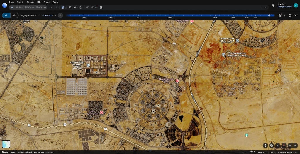
To corroborate whether this specific desert parcel actually hosted the facility, the coordinates for The Octagon were located and examined on Google Earth:
- Reference Points: The sweeping curved highway running along the eastern flank, the distinct rocky ridges, and the surrounding grid layout immediately aligned with the baseline terrain in the challenge prompt.
- Modern Footprint: The modern satellite layer clearly reveals the fully constructed octagonal compound occupying the exact coordinate grid.
Step 4: Verification via Historical Imagery
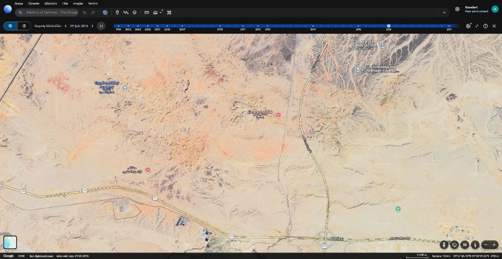
The final confirmation required verifying that the challenge’s 2013-era barren landscape matched this exact site prior to construction.
Using the Historical Imagery slider on Google Earth to roll back the timeline (February 29, 2016 imagery layer):
- The modern mega-structures disappear, revealing the raw desert topography.
- Drainage gullies, geological rock cuts, and the curving road network match the challenge prompt pixel for pixel.
- The faint boundary scars visible in the prompt match the initial footprint and grading of the site.
A textbook example of combining linguistic clue analysis with historical satellite cross-referencing. Huge thanks to Jake Godin and Bellingcat for designing another engaging GEOINT CTF!
Originally published on Substack