UK OSINT Community: Operation Levant – Point of Origin Write-up
Bu çözümün Türkçesi de var: sağ üstten dili TR yapın.
Overview & Case Briefing
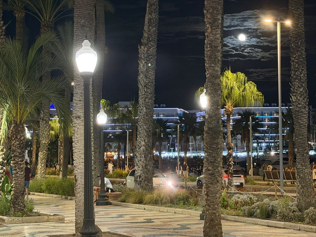
In the September cycle of the UK OSINT Community Monthly Challenge, the investigative scenario opened with Case 26-0901: Operation Levant. The objective was to trace the digital footprint of Freya Hale, a 24-year-old British traveler last contacted in Alicante, Spain. The initial challenge, Point of Origin, required determining the exact coordinates from which a single night photograph (01_explanada.jpg) was taken.
Initial Visual Assessment
A baseline inspection of the supplied image provided several environmental signatures:
- Atmosphere & Vegetation: The dense rows of tall date palms (Phoenix dactylifera) and coastal flora pointed toward a typical Mediterranean coastal setting.
- Urban Infrastructure: The presence of compact European cars parked along the street and contemporary blue/white architectural lighting suggested Southern Europe.
- Pavement Texture: The pedestrian promenade was paved with a distinct, undulating wave mosaic in red, cream, and dark tones.
Visual Search & Landmark Identification
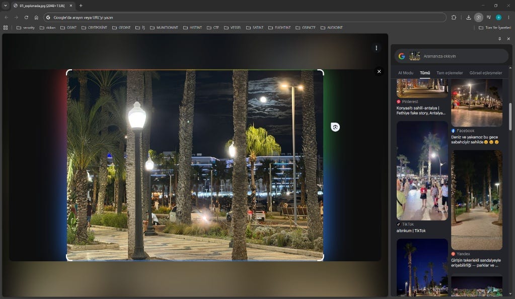
- Full-Frame Reverse Search Attempt:
An initial full-frame query via Google Lens returned noisy results, pointing generically to Turkish coastal promenades (such as Antalya and Fethiye) due to the dominating palm silhouettes and light flares.
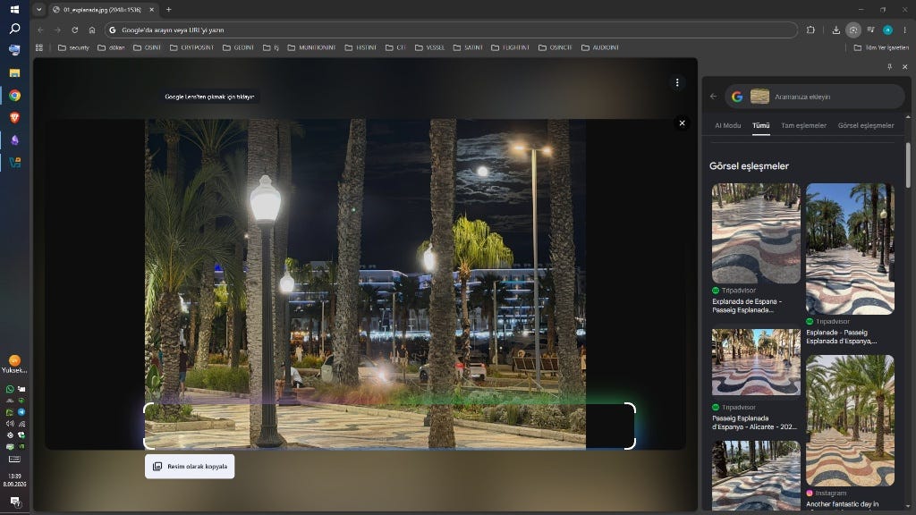
2.Feature Isolation (Mosaic Pattern):
To eliminate visual noise, the search frame was cropped exclusively to the distinctive wavy floor tiles at the bottom of the image. This immediately isolated the unique paving pattern of Passeig Esplanada d’Espanya in Alicante, Spain
Geospatial Alignment & Result
With the specific boulevard confirmed:
- Background Perspective: The horizontally terraced structure illuminated in neon matched the commercial building along Muelle de Levante across the roadway.
- Camera Placement: Aligning the sightline south-southeast toward the marina positioned the vantage point near the public water fountain (Fuente de agua - Explanada de España) and the pedestrian crossing.
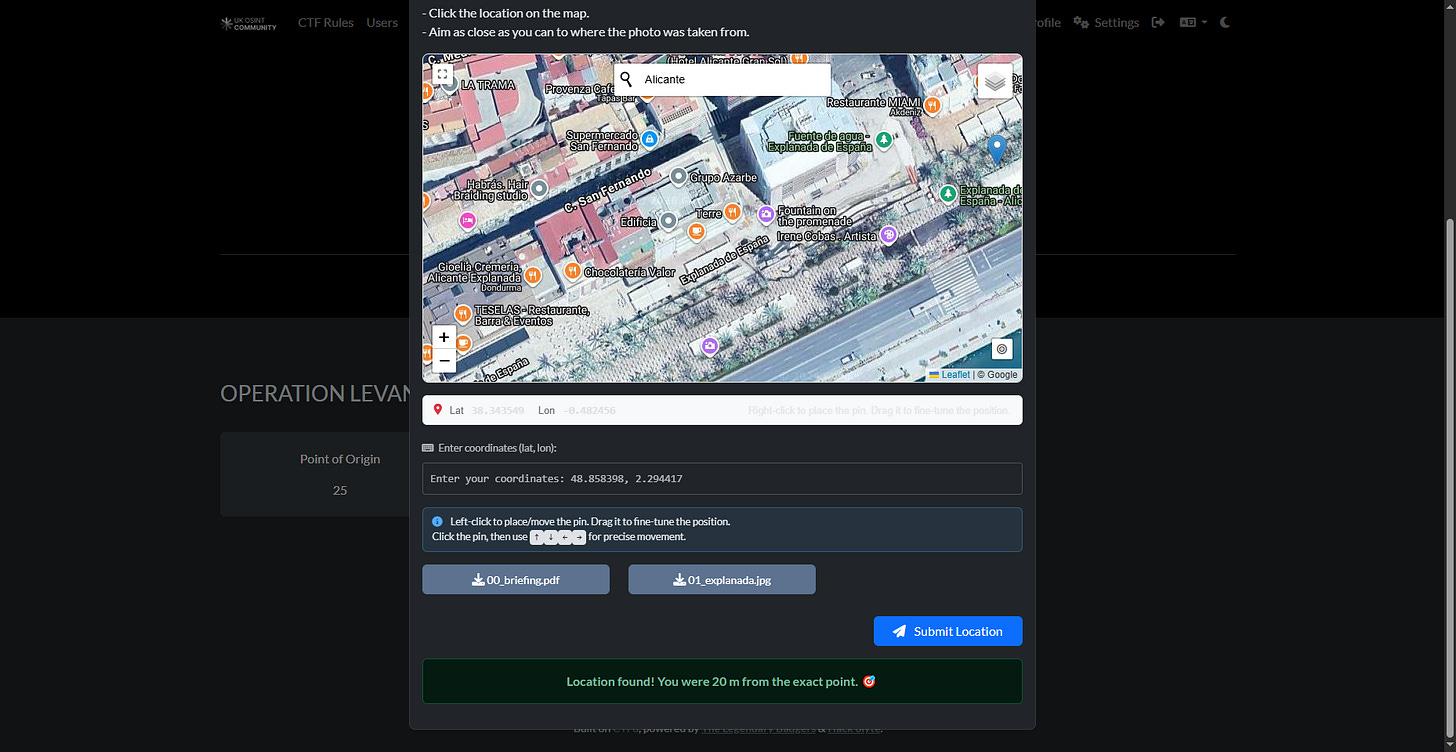
Submitting the location at this promenade segment successfully resolved the Point of Origin task within a 20-meter tolerance.
Originally published on Substack