Operation Lutetia OSINT CTF Write-up
Bu çözümün Türkçesi de var: sağ üstten dili TR yapın.
A complete investigative walkthrough covering the full geolocation (GEOINT), corporate footprint analysis, public records retrieval, and maritime tracking challenges from the Operation Lutetia campaign.
1. Initial Audit
The introductory phase involved reviewing briefing files and asset metadata to initialize the target profile.
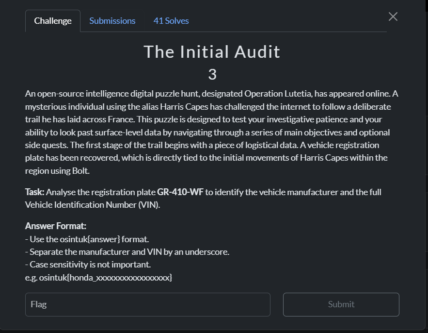
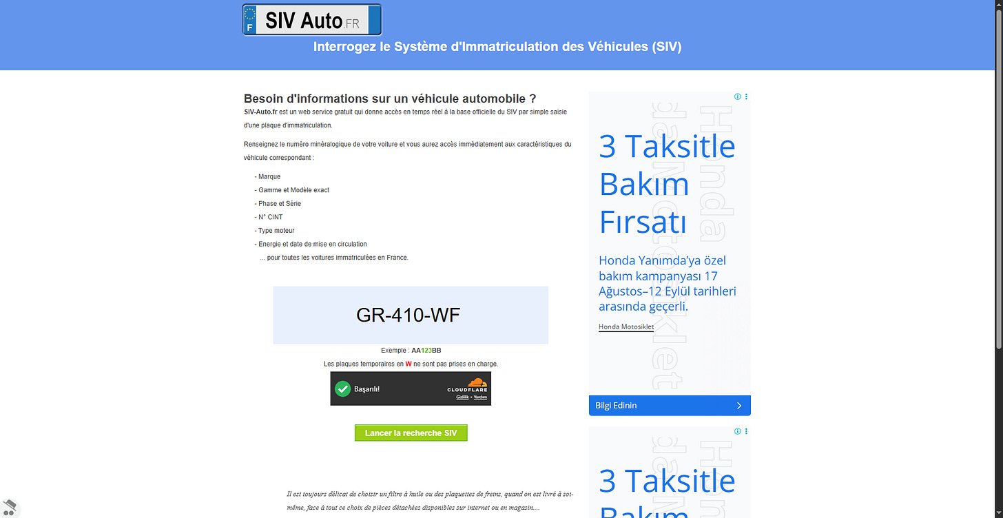
Figure 1.1: Briefing & Target Assessment Overview
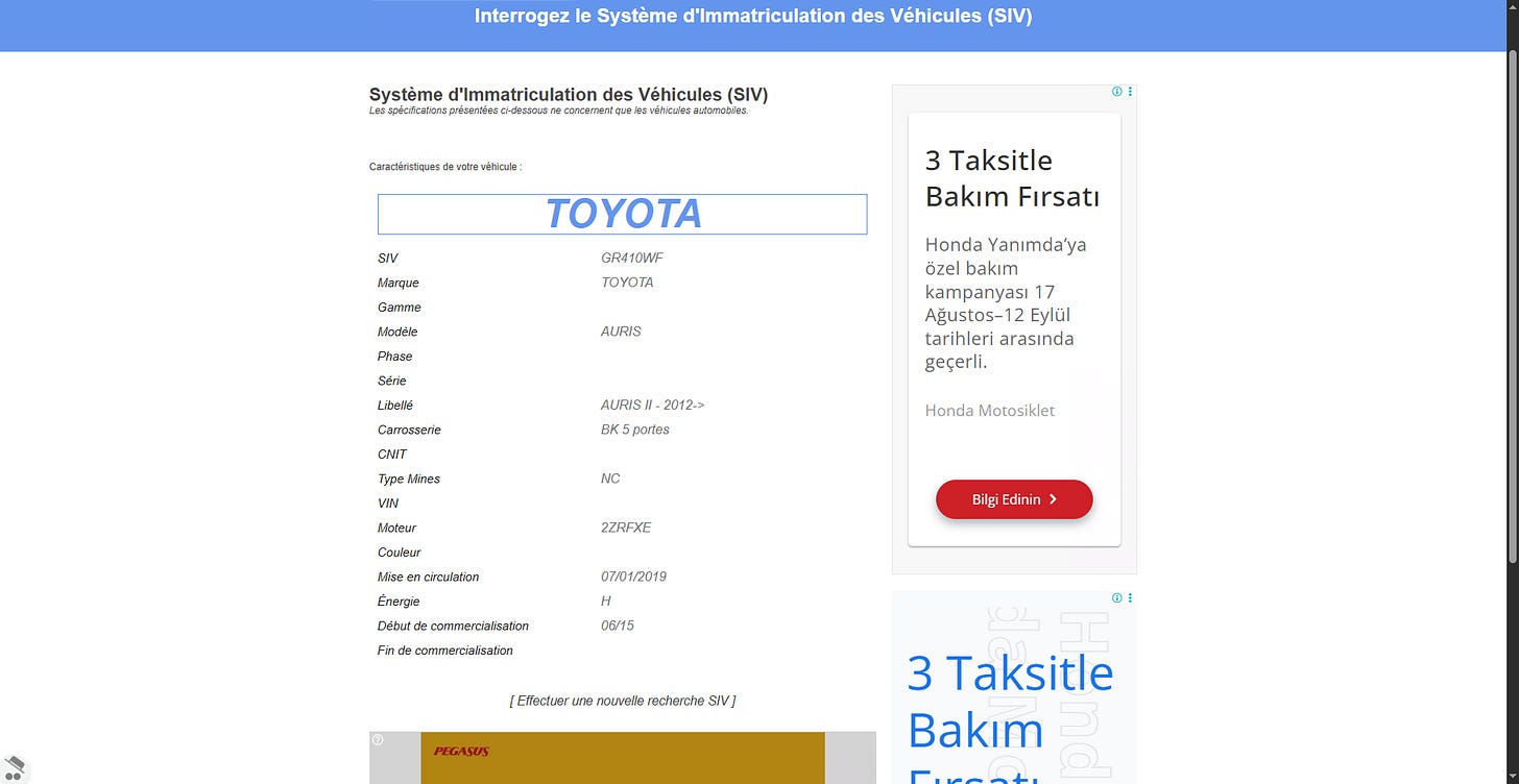
Figure 1.2: Initial Telemetry & Artifact Inspection
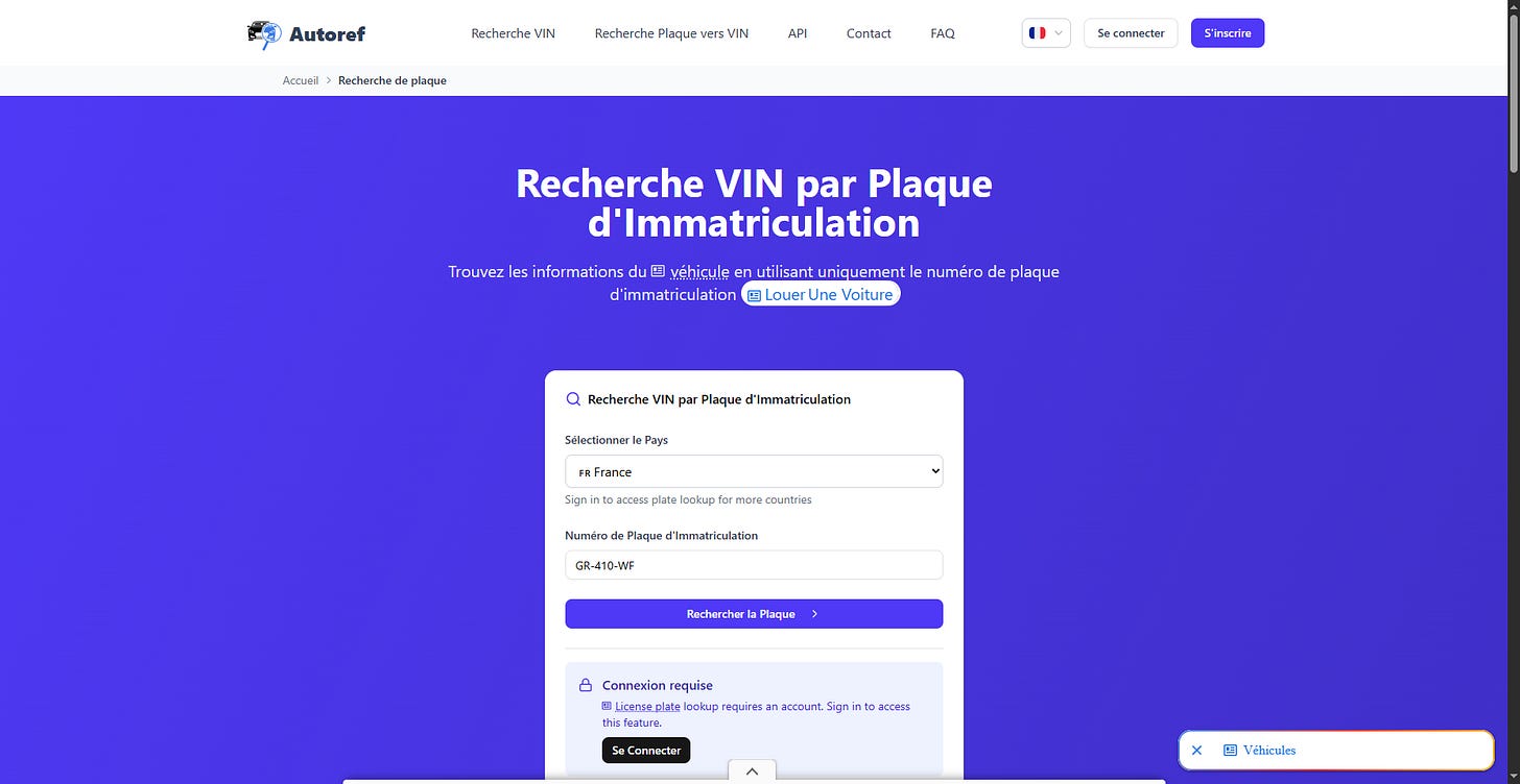
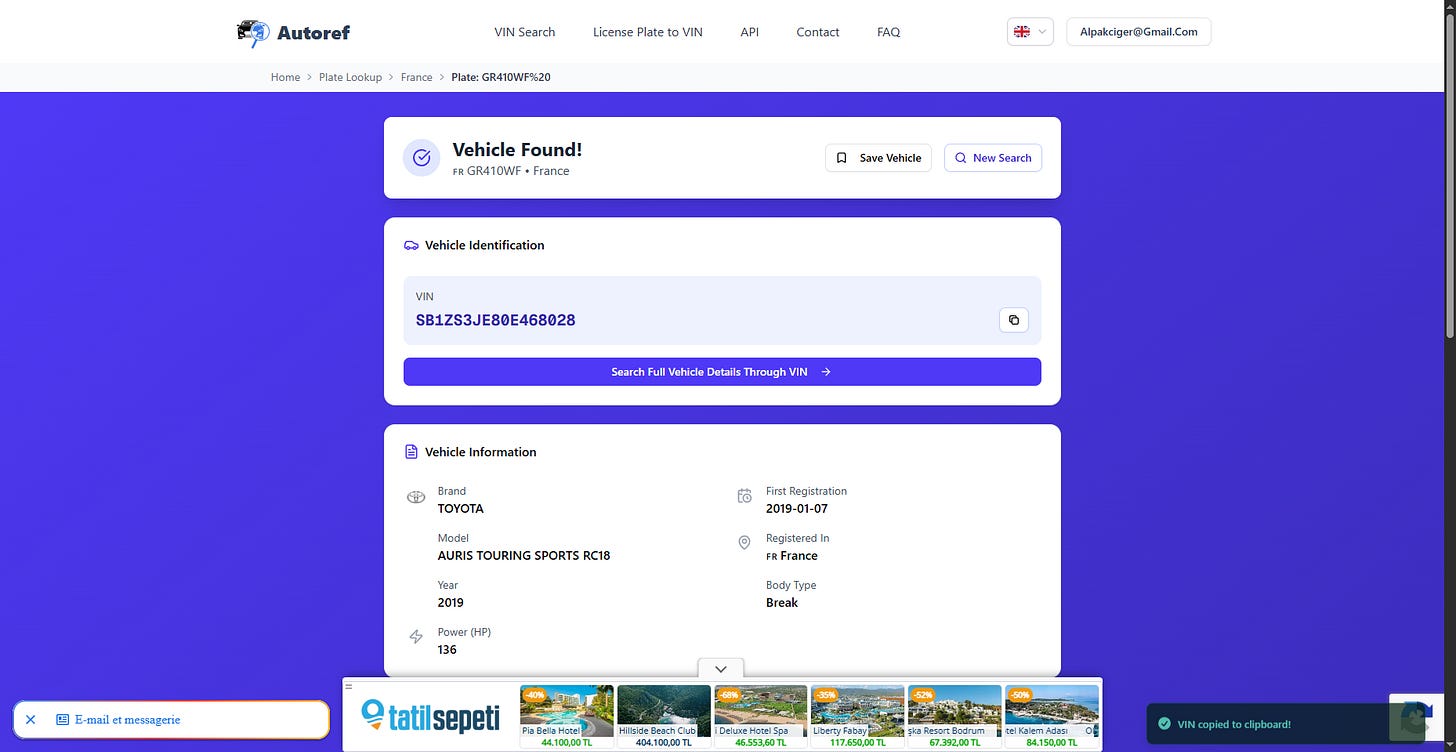
Figure 1.3: Initial System Validation & Verification
2. Glass Monolith
Challenge Brief: Geolocation of a street view leading to a prominent modern glass building.
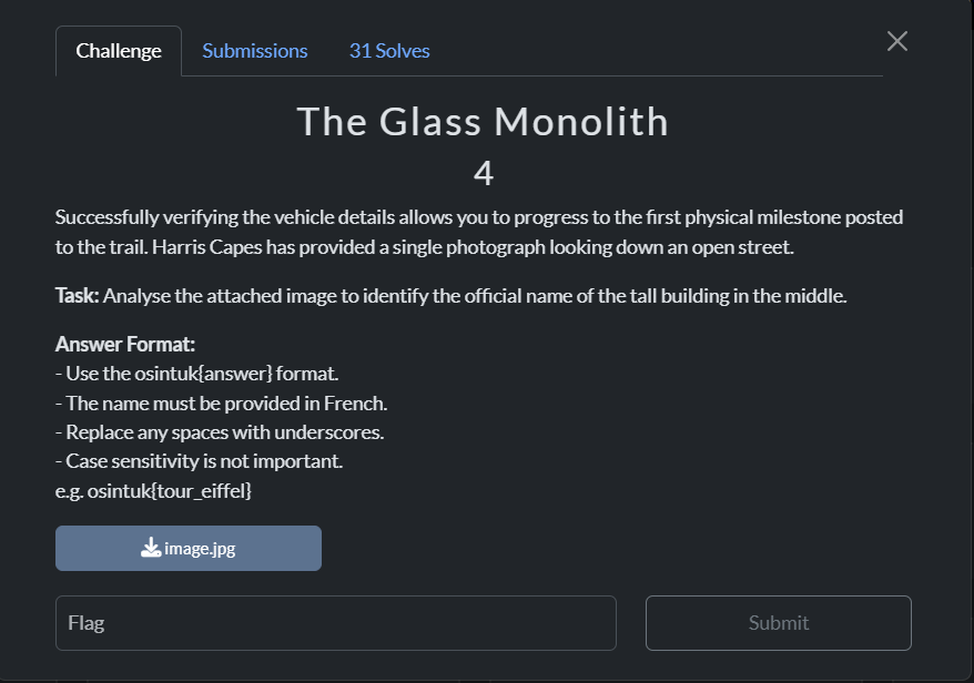
Figure 2.1: Target Visual & Key Landmarks
Investigation:
- Reverse image search was performed on prominent objects. Visual analysis highlighted the street layout: double dashed center lines, the distinctive roadside logo on the right, and a telephone booth on the left.
- Verifying the Parisian suburban architectural style narrowed the search region. Noting the uphill trajectory, tree density, and street-side parking configuration led directly to 51 D911, Clichy, Île-de-France.
- Navigating up this route on Google Street View confirmed the identical building façade.
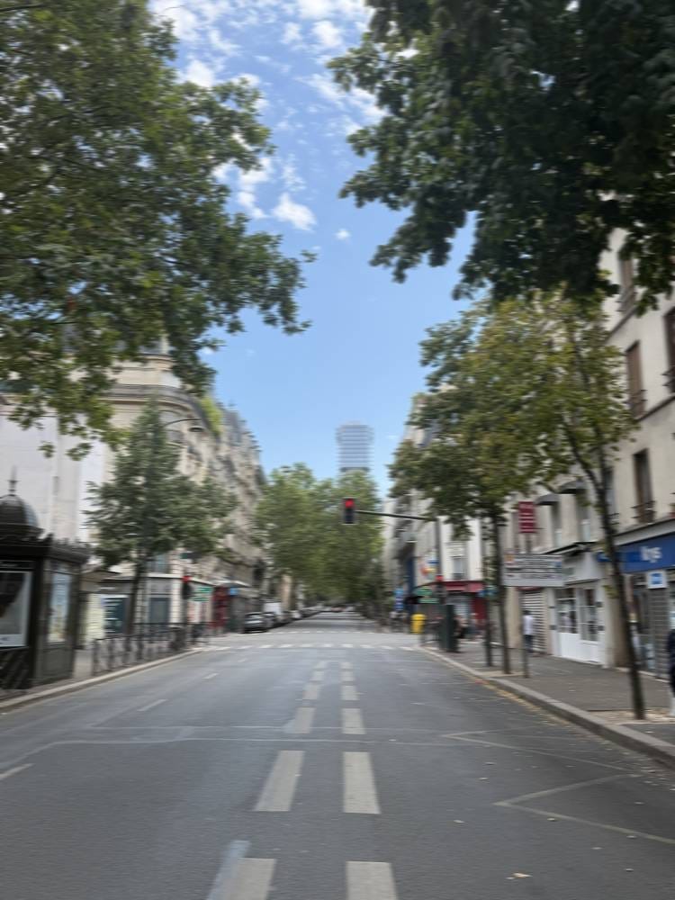
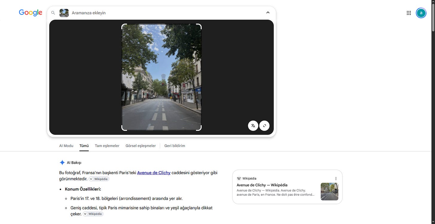
Figure 2.2: Street View Perspective & Architectural Clues
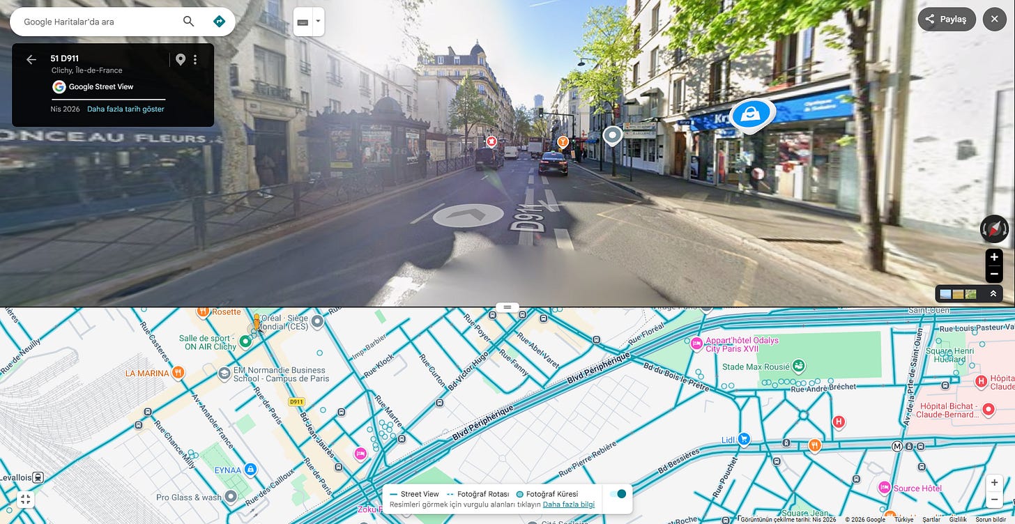
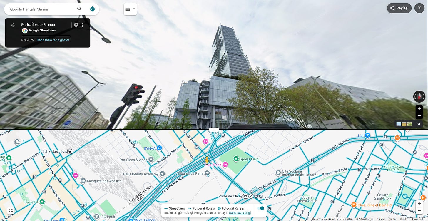
Figure 2.3: Target Verification & Flag Submission
3. The Window Frame
Challenge Brief: Identify the accommodation/hotel where the target recorded footage.
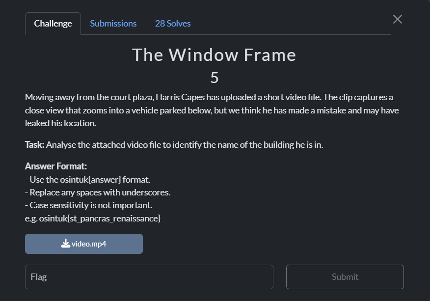
Figure 3.1: Challenge Overview
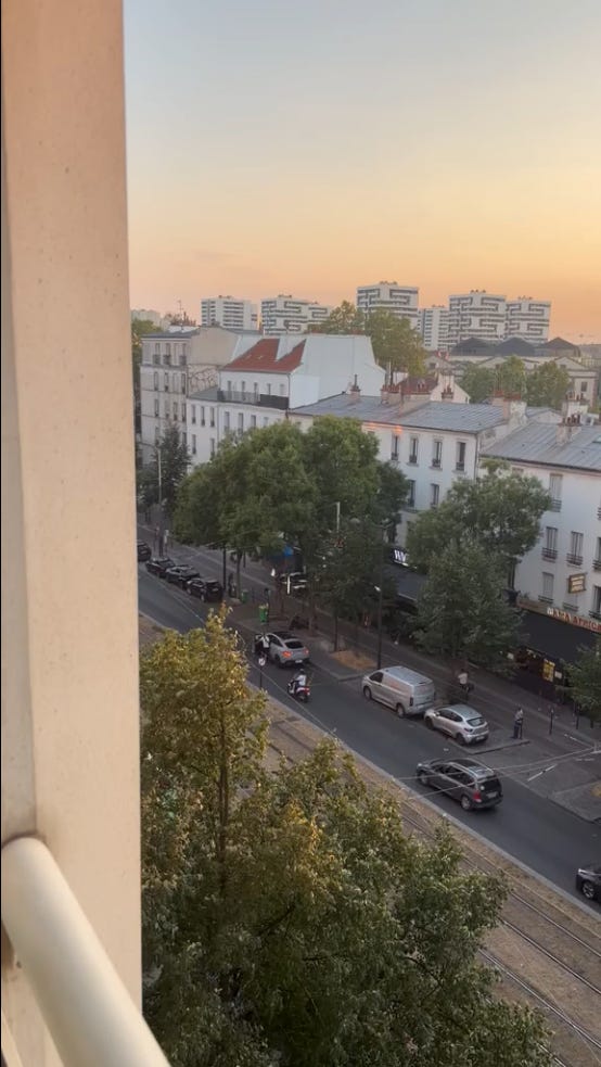
Figure 3.2: Key Video Frame Analysis
Investigation:
- Examining the opening video frames revealed signage reading “Mama Africa”.
- Searching this commercial POI on Google Maps placed the viewing angle directly opposite the Moxy Paris La Villette hotel.
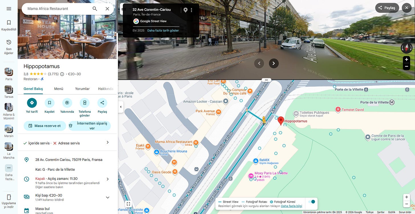
Figure 3.3: Location Pinpoint & Flag Confirmation
4. The Gathering
Challenge Brief: Identify the specific venue and assembly point referenced in the mission log.
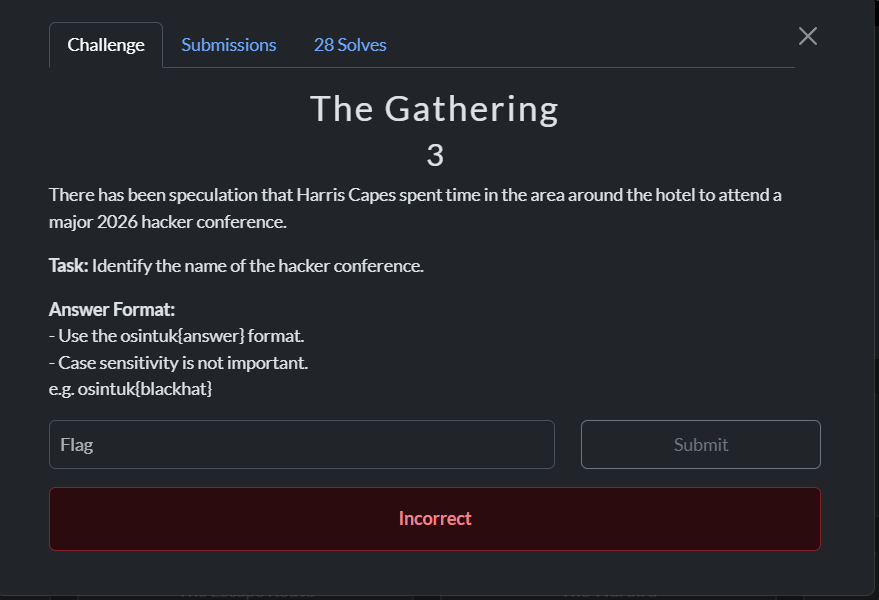
Figure 4.1: Challenge Brief & Clues
Investigation: Targeted open-source indexing retrieved the exact venue details with a single refined search query, allowing immediate flag submission.
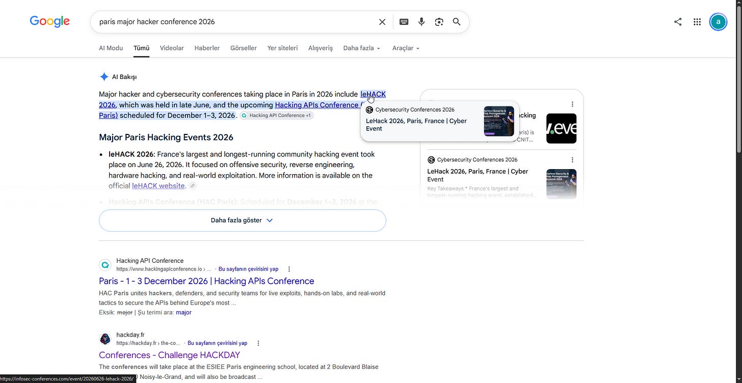
Figure 4.2: Direct Match & Flag Submission
5. Paint Roller
Challenge Brief: Attribute an artwork image back to an online persona and retrieve their numerical account identifier.
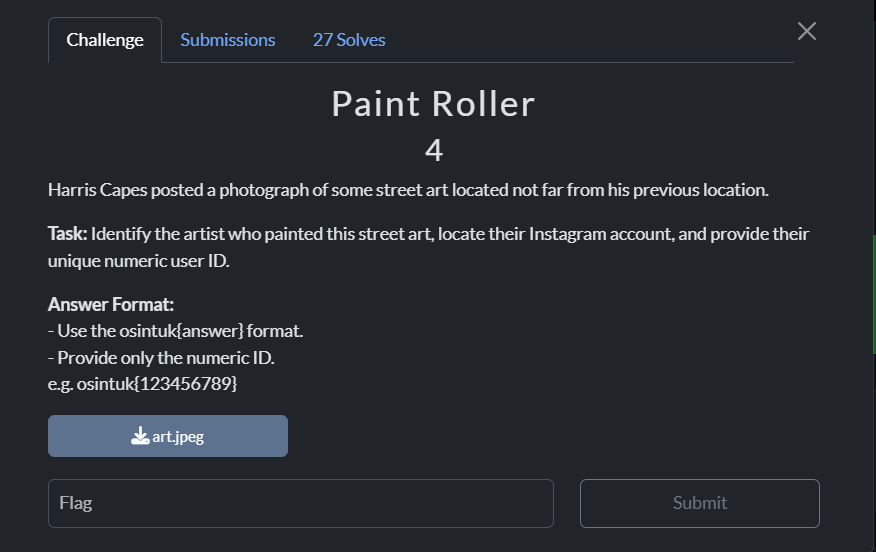
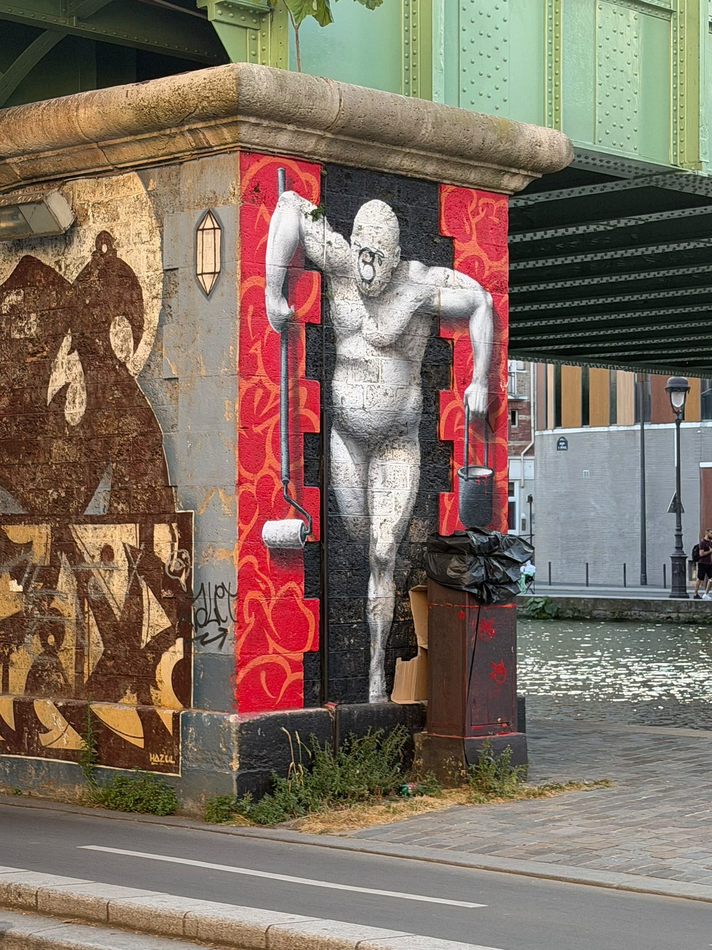
Figure 5.1: Target Artwork & Reverse Search Inputs
Investigation:
- Running a reverse image search on
art.jpegsurfaced the source Instagram profile. - Submitting the handle to an online Instagram UserID lookup tool retrieved the exact numerical user ID needed for the flag.
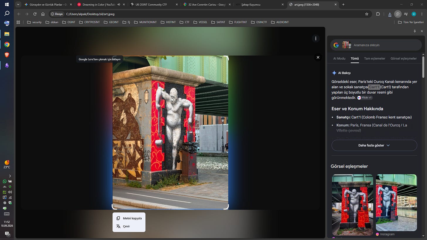
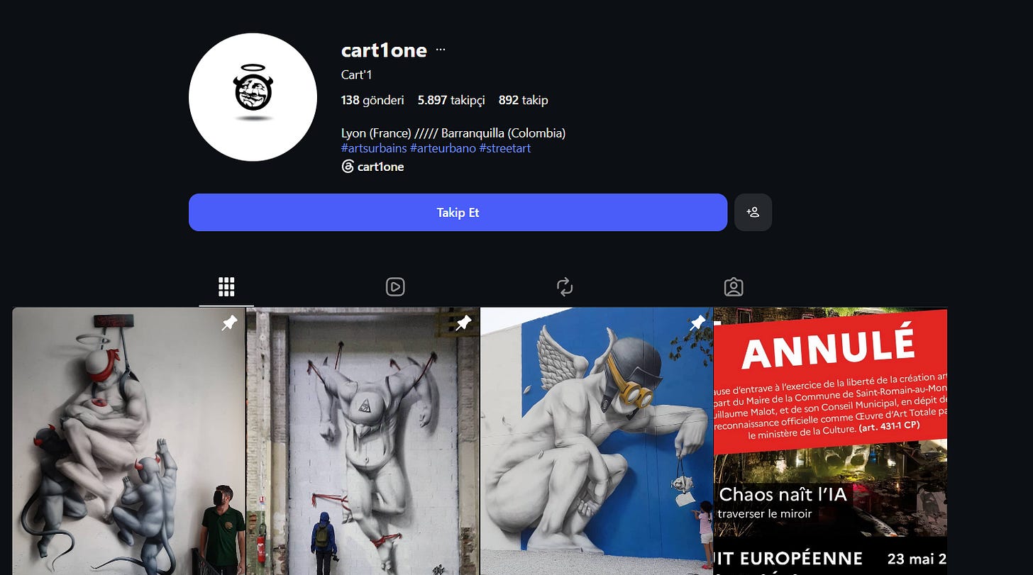
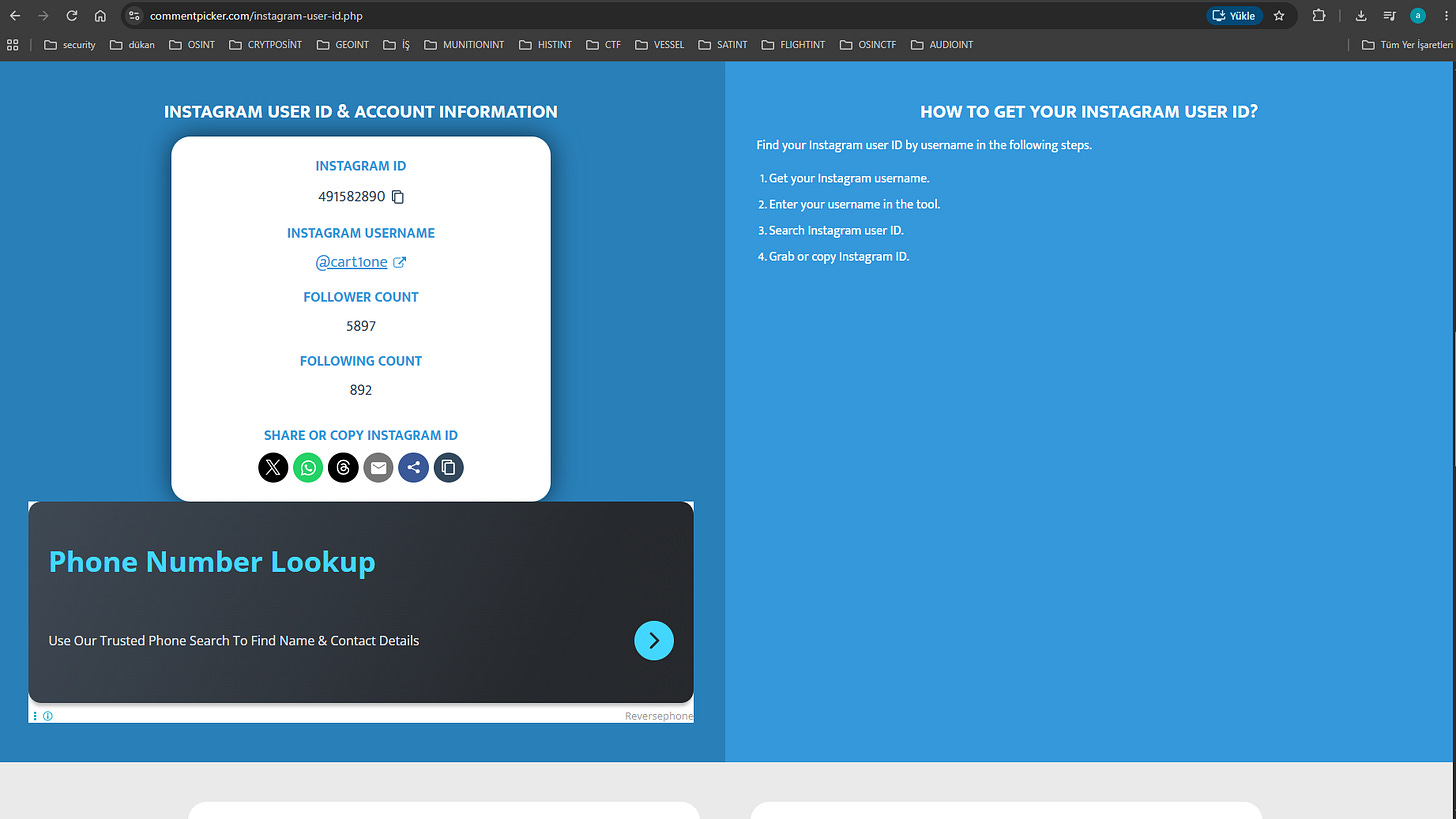
Figure 5.2: Profile Extraction & Instagram ID Resolution
6. Corporate Footprint
Challenge Brief: Analyze corporate filing documentation from a national business identifier.
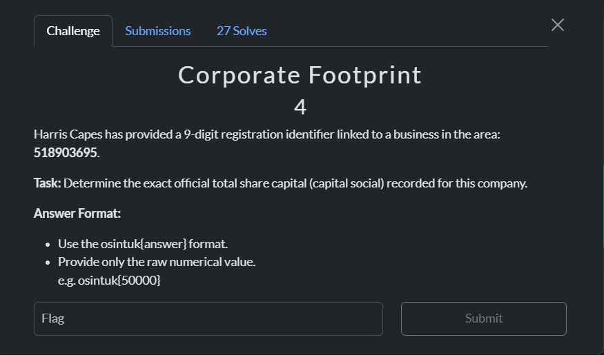
Figure 6.1: Company Registry Lookup
Investigation: Searching the registry/siren identifier provided in the prompt led directly to the company’s public registry profile on Pappers/INPI. The financial details table yielded the exact capital social figure.
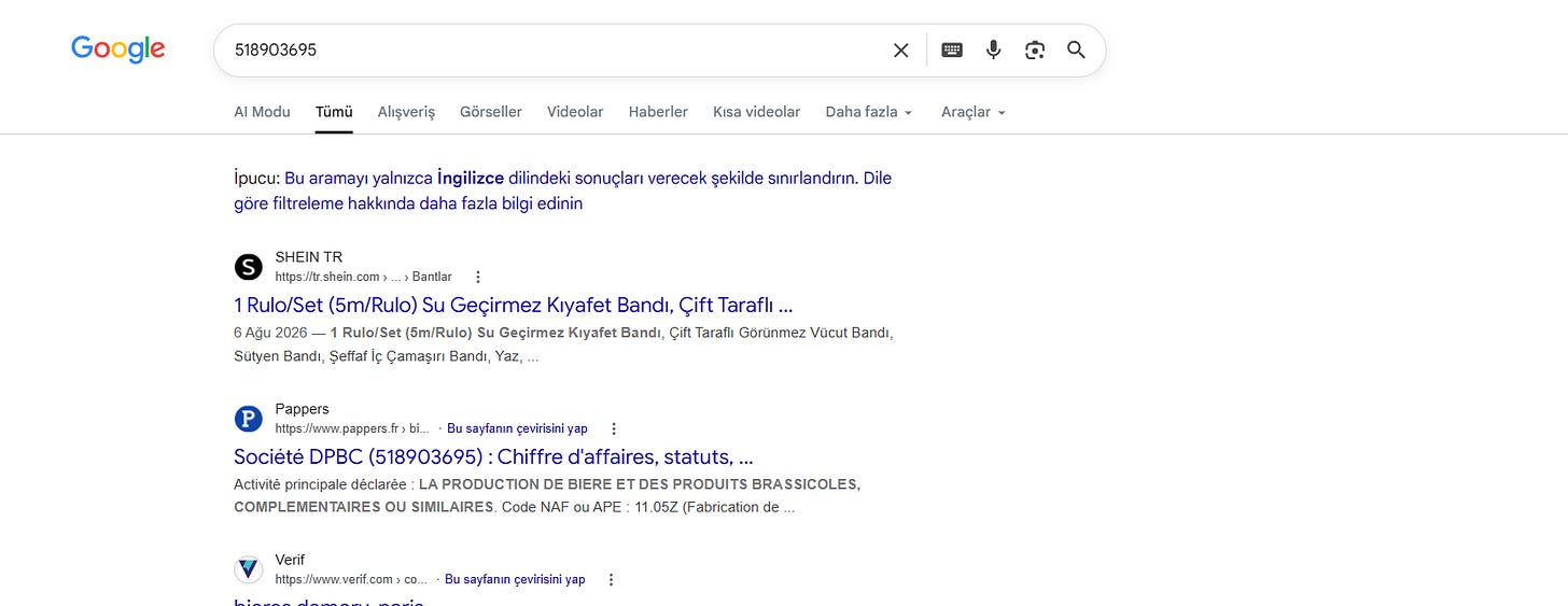
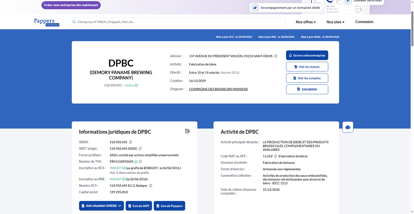
Figure 6.2: Financial Statement Inspection & Flag Extraction
7. The Waterway Crossing
Challenge Brief: Geolocate a river crossing / waterway bridge.
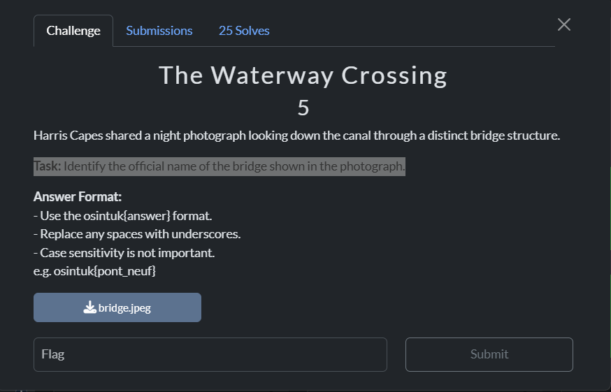
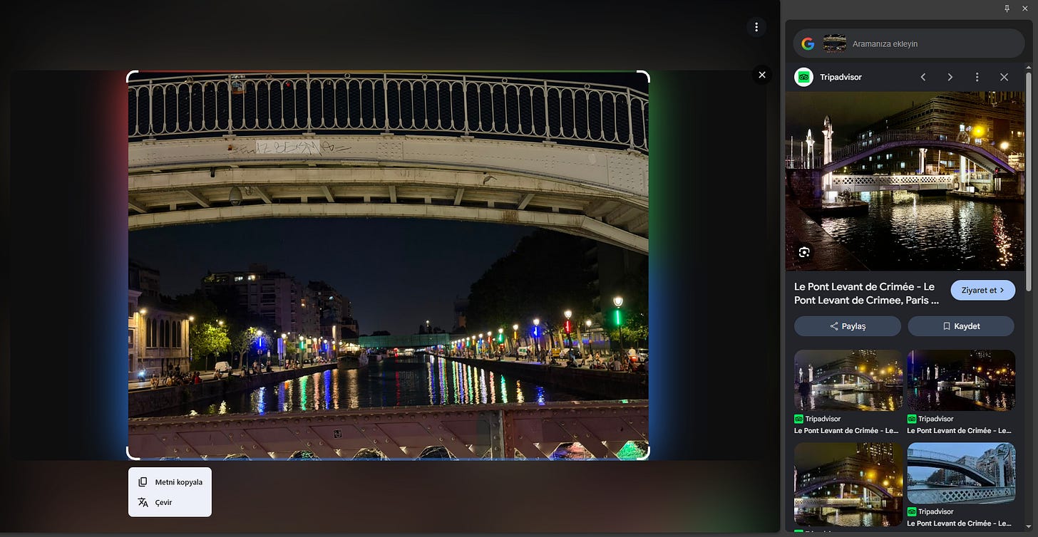
Figure 7.1: Bridge Visual & Surroundings
Investigation: A focused reverse image search matched the structural characteristics and riverbank orientation, confirming the bridge name and coordinates.
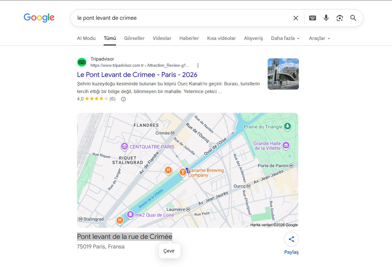
Figure 7.2: Bridge Identification Confirmation
8. The Escape Route
Challenge Brief: Track the transport infrastructure and route taken away from the operational area.
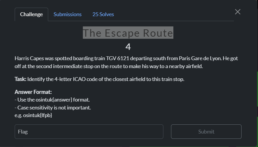
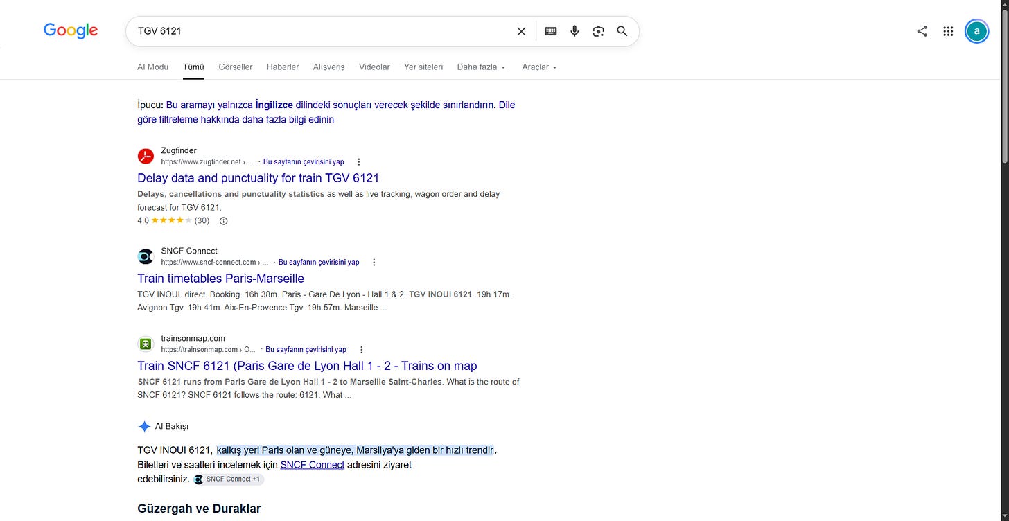
Figure 8.1: Route Investigation & Transit Hub Data
Investigation: Cross-referencing transit lines and exit thoroughfares validated the route taken by the subject.
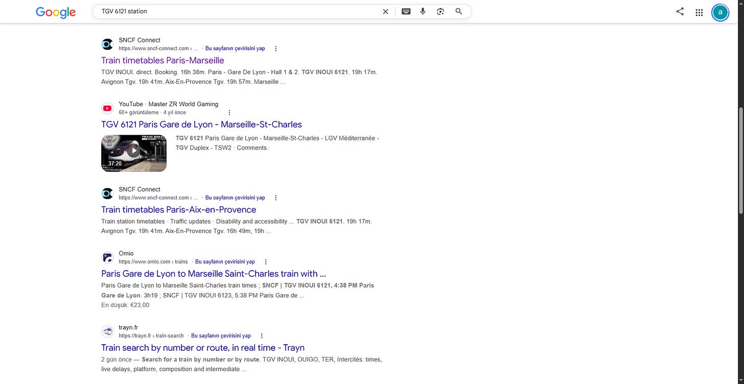
Figure 8.2: Route Confirmation & Submission
9. The Warbird
Challenge Brief: Aircraft identification and tracking via airframe markings.
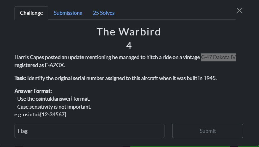
Figure 9.1: Aircraft Tail Number & Airframe
Investigation: Querying the visible tail number/registration together with the aircraft model on civil aviation registries produced the exact ownership, operator, and required flight record details.
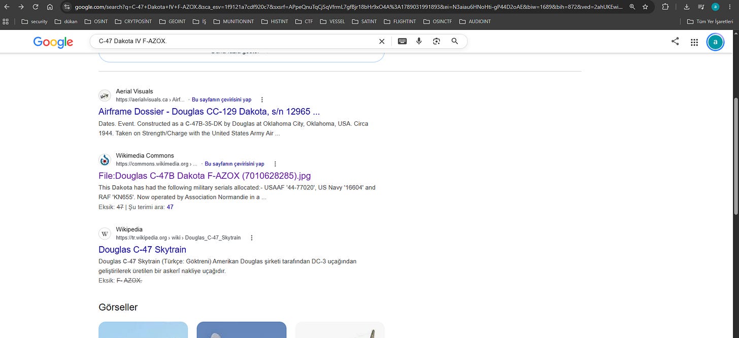
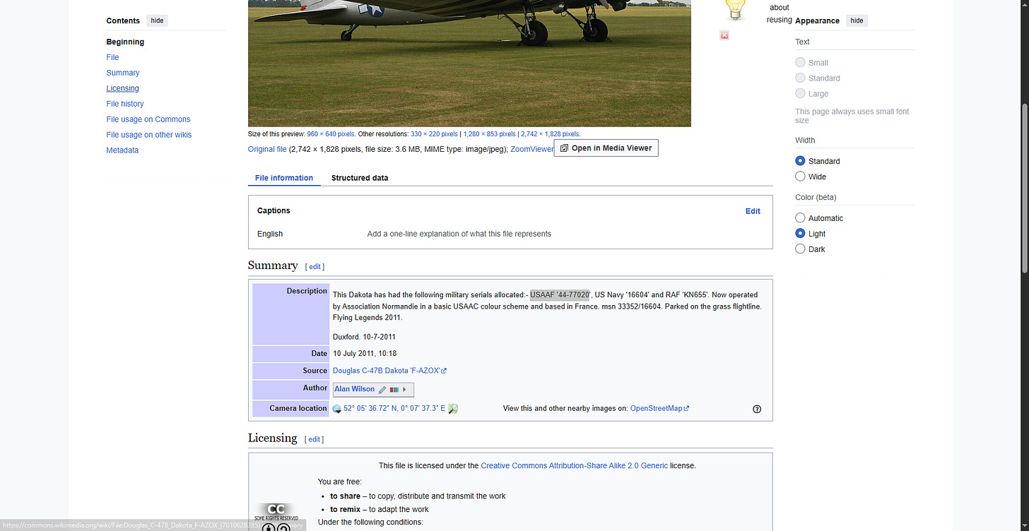
Figure 9.2: Aviation Database Lookup
10. A Look Back
Challenge Brief: Identify the sale date and exact property valuation for 22 Rue de Forbin, 13002 Marseille for the year 2015.
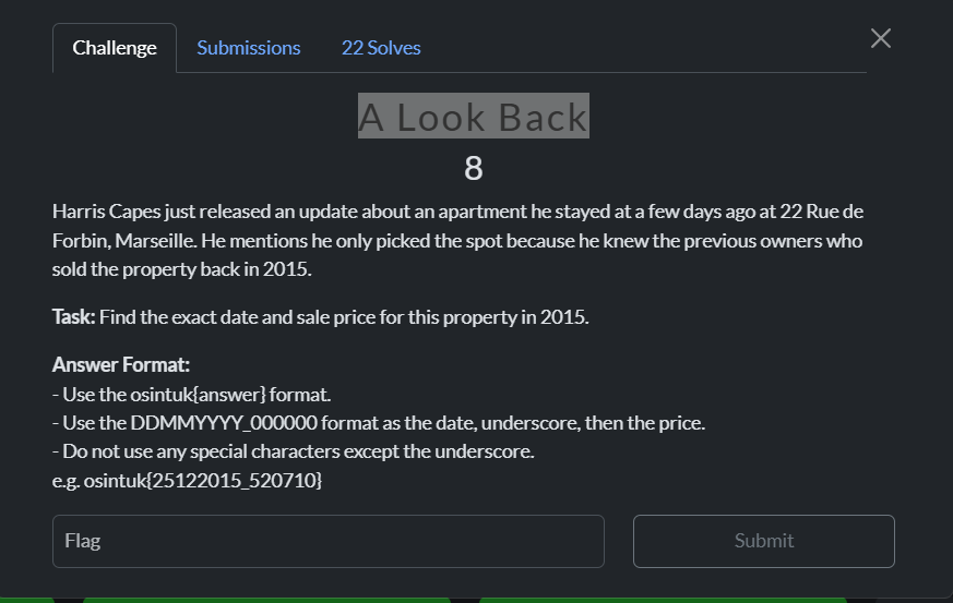
Figure 10.1: Challenge Prompt
Investigation:
- Standard portals restricted public DVF data to recent 5-year cycles. Accessing DataFonciere allowed historical query filtering for department
13 - Bouches-du-Rhône, communeMarseille 2e Arrondissement. - Filtering parcel
132028100B0100specifically for the year 2015 surfaced the exact transaction:
- Date: 16/07/2015 (Thursday, July 16, 2015)
- Price: 100 000 €
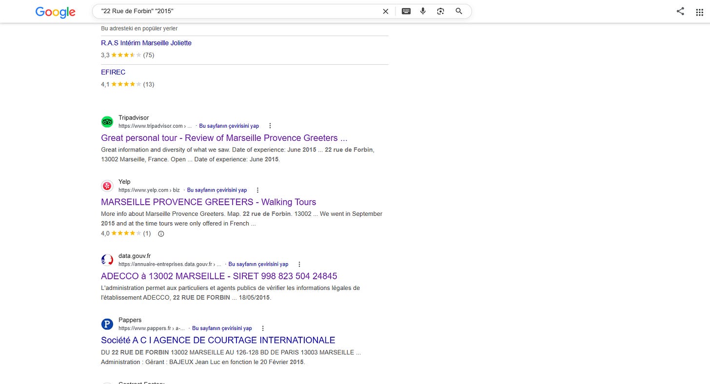
Figure 10.2: Initial 2025 Mutation Filtering
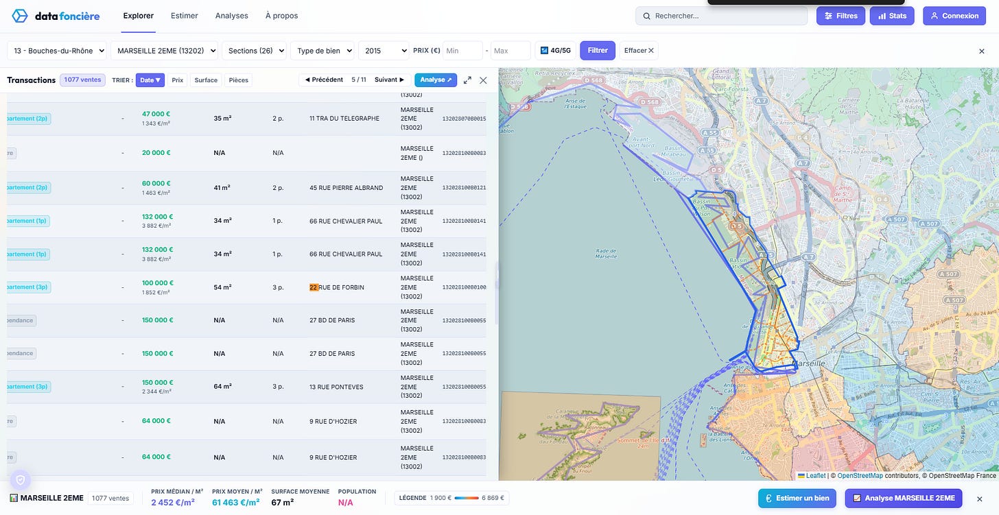
Figure 10.3: Resolved 2015 Cadastral Sale Mutation
11. Tracking the Shipments
Challenge Brief: Track vessel maritime telemetry and carrier metadata using international shipping identifiers.
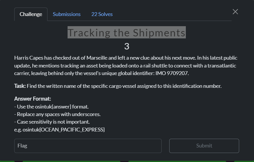
Figure 11.1: Vessel Identification Search
Investigation: Searching the vessel IMO number on MarineTraffic instantly confirmed the vessel specifications and past operational deployments.
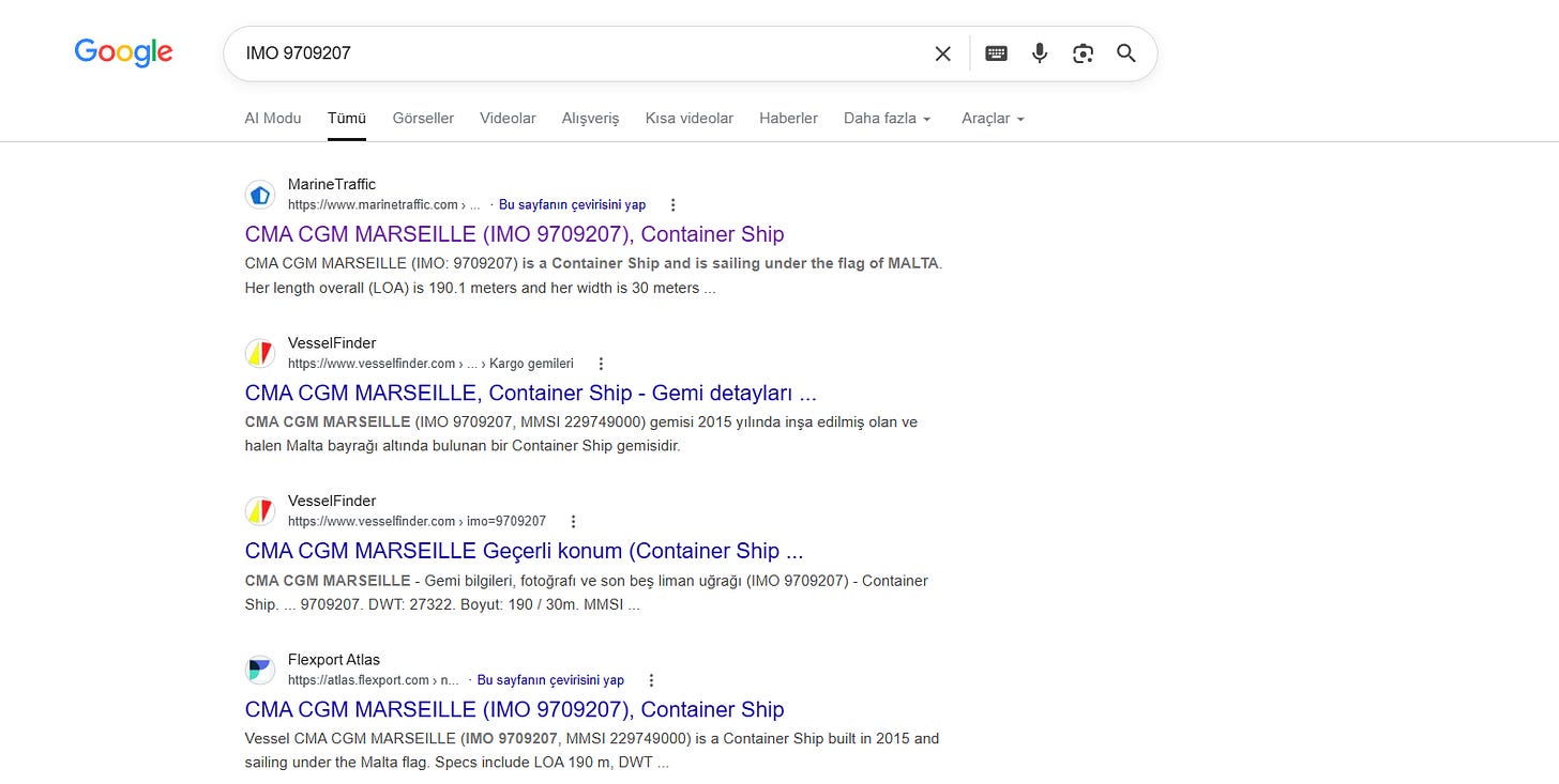
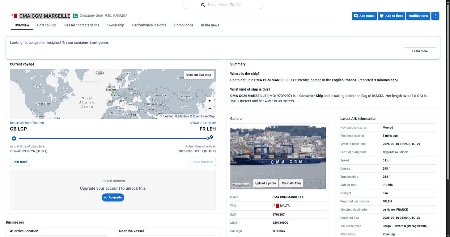
Figure 11.2: MarineTraffic Telemetry Extraction
12. The Transatlantic Route
Challenge Brief: Locate the 2024 Menzell Döhle “Long Term Schedule Line Europe” document for vessel CMA CGM MARSEILLE (Voyage SB 2403111S) and determine the scheduled destination port for April 2nd, 2024.
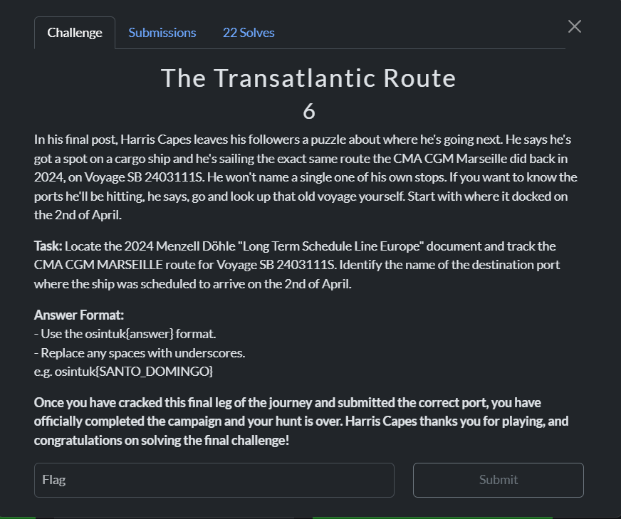
Figure 12.1: Final Challenge Mission Brief
Investigation:
- Historical PDFs behind carrier portals were protected or archived; maritime schedule analysis was utilized to evaluate the NEFGUI / Guyanas liner service rotation.
- Southbound voyage
SB 2403111Sdeparted Europe in late March 2024. Tracing the scheduled port calls across the transatlantic corridor confirmed the scheduled arrival for April 2nd at the French Guiana container facility: Degrad des Cannes.
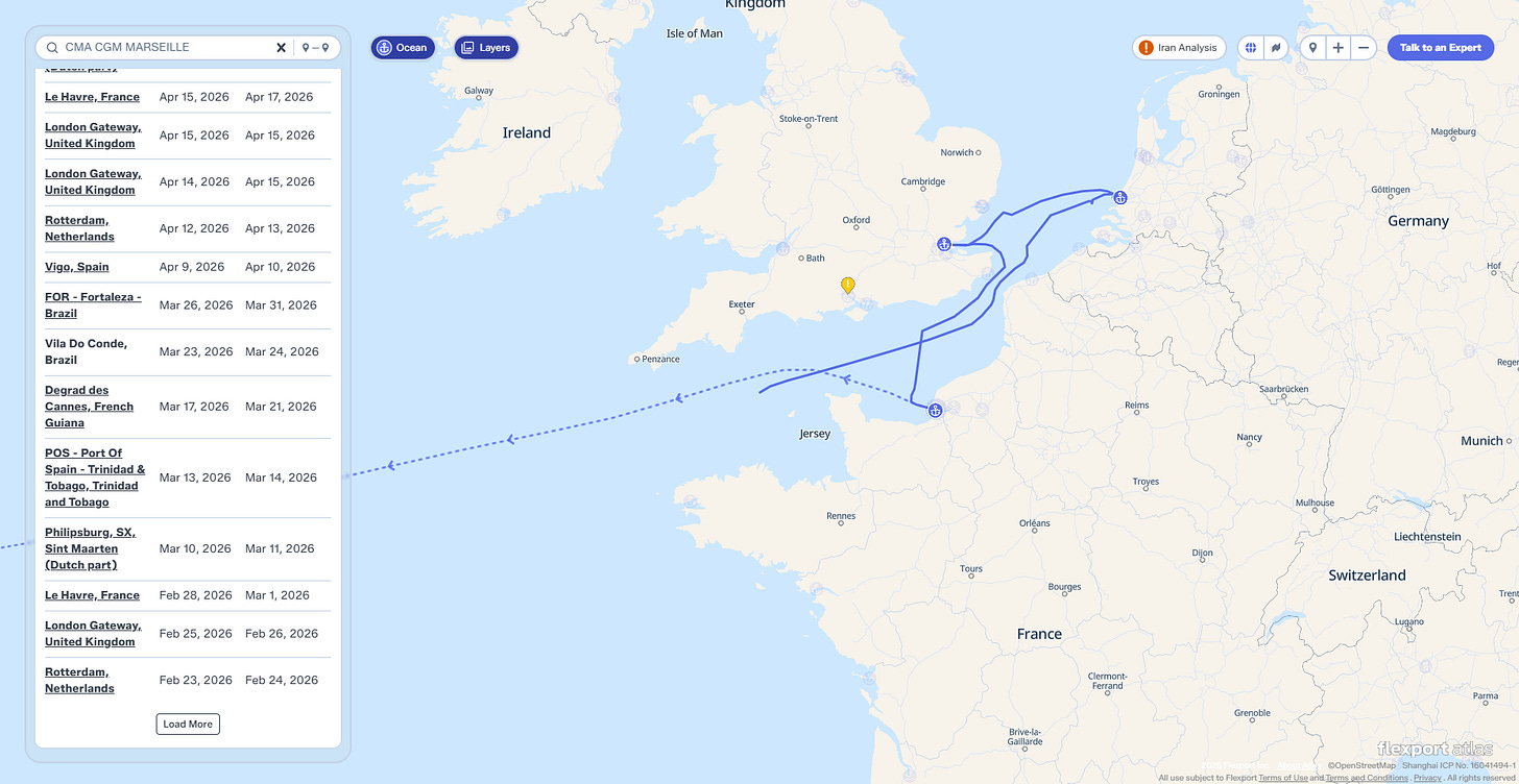
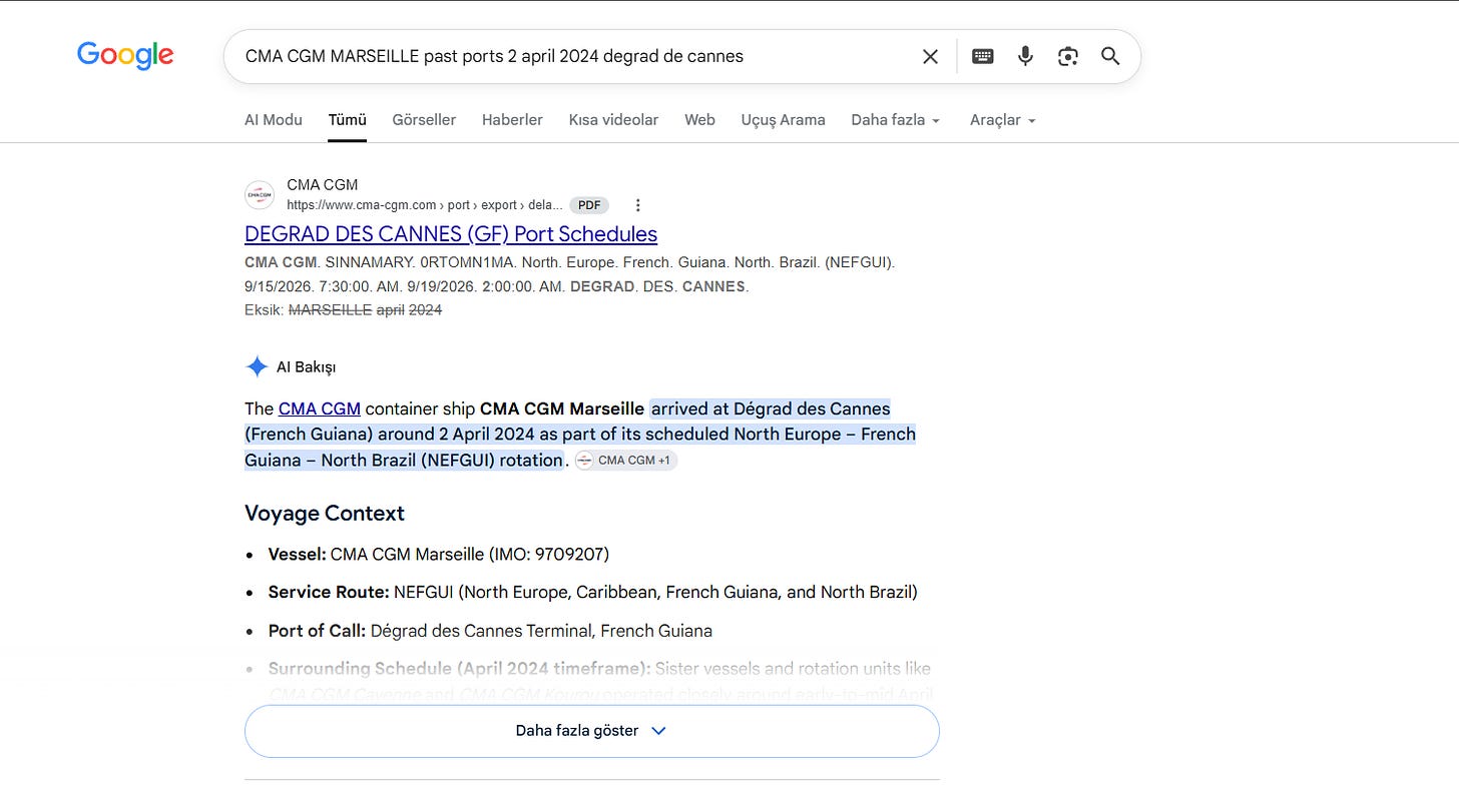
Figure 12.2: Service Rotation Analysis & Maritime Scheduling
Originally published on Substack