Fairford Suspects: Geolocation Walkthrough
Bu çözümün Türkçesi de var: sağ üstten dili TR yapın.
Introduction
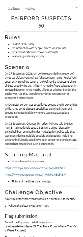
A challenge created by OSINT Newsletter tasked investigators with identifying the precise location where three suspicious vehicles were photographed.
On September 27, 2026, UK police intercepted three vans bearing false “Fuel 2 You” branding heading toward RAF Fairford in Gloucestershire. Counter terrorism officers arrested five individuals in the neighboring settlement of Whelford, establishing a 400 meter exclusion cordon and evacuating approximately 85 local homes while explosive ordnance disposal units assessed the vehicles.
Special thanks to OSINT Newsletter for setting up this realistic, high value geospatial scenario.
Step 1: Macro Location and Perimeter Alignment
The broadcast aerial view from France 2 (20h Week-End) framed the incident zone alongside the operational boundaries of RAF Fairford.
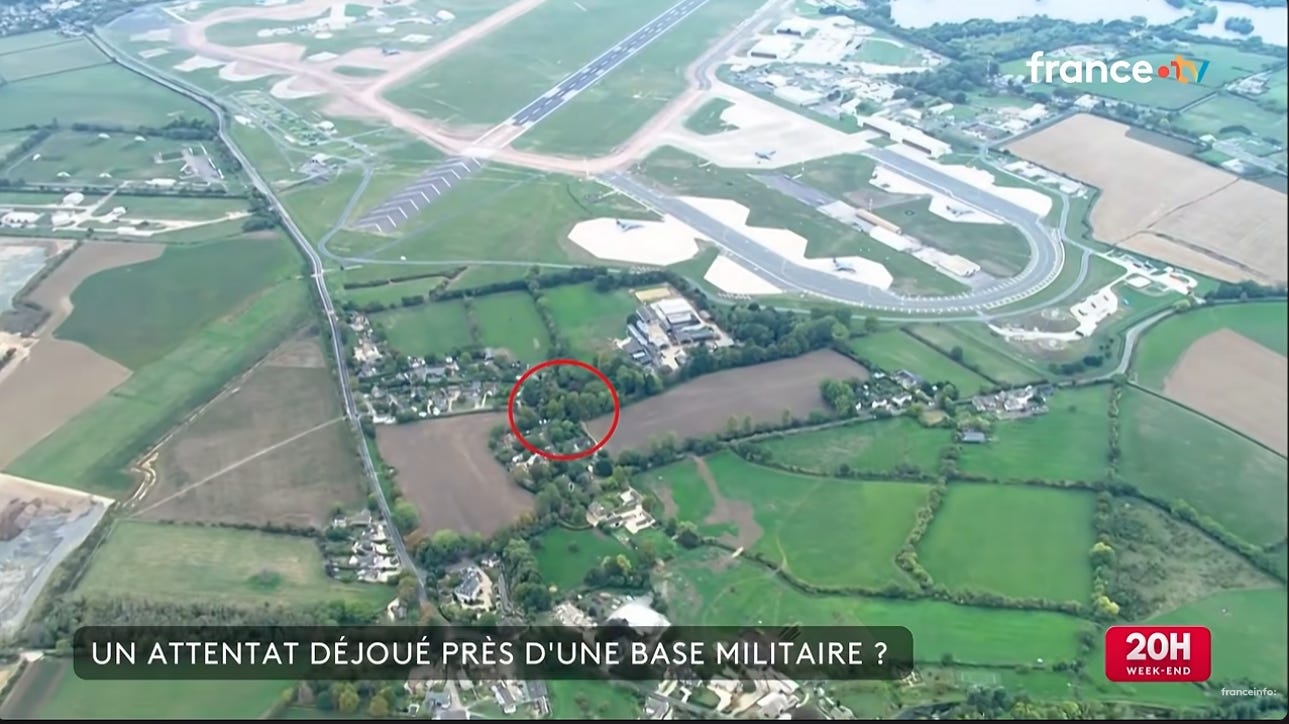
The tarmac configuration shows the secondary access loop and taxiway curve hugging the southern base perimeter rather than a curved runway. Measuring directly southeast from the southeastern runway threshold points toward the agricultural cluster dividing Horcott and Whelford.
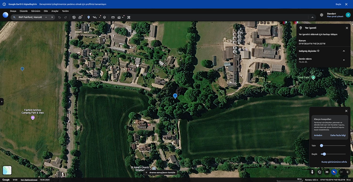
Satellite imagery from Google Earth confirms key geographic anchors:
- The facility boundary runs approximately 700 meters southeast of the main airfield perimeter fence.
- Horcott Road acts as the primary transit artery feeding traffic from Fairford eastward into Whelford.
- Dense deciduous tree clusters frame the northern and western margins of the residential parcels, isolating them from open farmland
.
Step 2: Micro Location and Feature Matching
The red circle in the France 2 aerial frame highlighted a pocket of structures situated along Horcott Road.
Cross referencing the news frame with overhead maps isolated three distinct matching markers:
- Structure Footprint: The rectangular building profile matches the community hall layout directly south of the roadway.
- Tree Cluster Alignment: A triangular patch of mature trees sits directly between Great Farm to the west and the community grounds to the east.
- Access Driveway: The gravel parking area adjacent to the main hall offered enough clearance for multiple service vans off the public lane.
Alternative locations along Horcott Road, including Great Farm and private cottages further north, do not match the public parking configuration or the reported evacuation zone. Drawing a 400 meter radius centered on this community hall car park encompasses the residential footprint of Whelford, perfectly aligning with the evacuation of roughly 85 households.
Conclusion and Verification
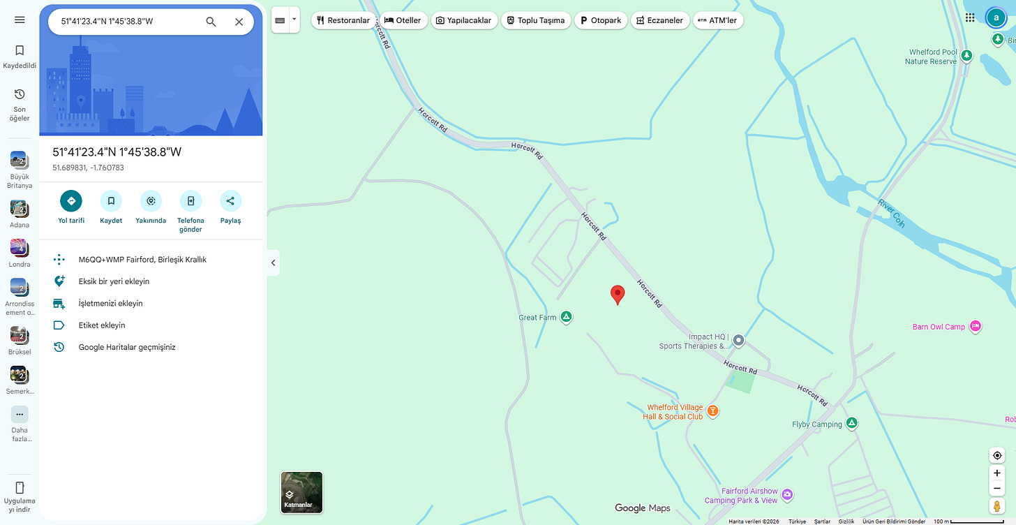
The target vehicles were parked and photographed on the grounds of the local community venue on Horcott Road.
- Location: Whelford Village Hall and Social Club
- Address: Horcott Road, Whelford, Fairford, GL7 4DT, United Kingdom
- Approximate Coordinates: 51.689831, -1.760783 (51°41’23.4”N 1°45’38.8”W)
Flag:
osintnewsletter{Whelford_Village_Hall_and_Social_Club}Originally published on Substack